martes, 27 de noviembre de 2012

NASA - NASA Hosts Nov. 29 News Conference About Mercury Polar Regions


Image from Orbit of Mercury: Mercury South Polar Region

Download Image

› Full Size
MESSENGER Provides New Look at Mercury's surprising core and landscape curiosities
03.21.12
 
Image from Orbit or Mercury: Mercury's Topography from MLAMercury's Topography from MLA
Full Image and Caption

Image from Orbit of Mercury: Mercury South Polar RegionMercury's South Polar Region
Full Image and Caption

Mercury South Pole Mercury’s South Polar Region
View Animation
Since moving into orbit about Mercury a little over one year ago, NASA's MESSENGER spacecraft has captured nearly 100,000 images and returned data that have revealed new information about the planet, including its topography, the structure of its core, and areas of permanent shadow at the poles that host the mysterious polar deposits.  The latest findings are reported in two papers published online in Science Express, and in 57 papers presented this week at the 43rd Lunar and Planetary Science Conference in The Woodlands, Texas.

A Surprising Core

MESSENGER's radio tracking has allowed the scientific team to develop the first precise model of Mercury's gravity field which, when combined with topographic data and the planet's spin state, sheds light on the planet's internal structure, the thickness of its crust, the size and state of its core, and its tectonic and thermal history.

Mercury's core occupies a large fraction of the planet, about 85% of the planetary radius, even larger than previous estimates. Because of the planet's small size, at one time many scientists thought the interior should have cooled to the point that the core would be solid. However, subtle dynamical motions measured from Earth-based radar, combined with MESSENGER's newly measured parameters of the gravity field and the characteristics of Mercury's internal magnetic field that signify an active core dynamo, indicate that the planet's core is at least partially liquid.

Mercury's core is different from any other planetary core in the Solar System. Earth has a metallic, liquid outer core sitting above a solid inner core. Mercury appears to have a solid silicate crust and mantle overlying a solid, iron sulfide outer core layer, a deeper liquid core layer, and possibly a solid inner core. These results have implications for how Mercury's magnetic field is generated and for understanding how the planet evolved thermally.

Landscape Curiosities

A planet's topography can reveal fundamental information about its internal structure and its geological and thermal evolution. Ranging observations from MESSENGER's Mercury Laser Altimeter (MLA) have provided the first-ever precise topographic model of the planet's northern hemisphere and characterized slopes and surface roughness over a range of spatial scales. From MESSENGER's eccentric, near-polar orbit, the MLA illuminates surface areas as wide as 15 to 100 meters (50 -325 feet), spaced about 400 meters apart (1,300 feet).

The spread in elevations is considerably smaller than those of Mars or the Moon. The most prominent feature is an extensive area of lowlands at high northern latitudes that hosts the volcanic northern plains. Within this lowland region is a broad topographic rise that formed after the volcanic plains were emplaced.

At mid-latitudes, the interior plains of the Caloris impact basin — 1,550 kilometers (960 miles) in diameter — have been modified so that part of the basin floor now stands higher than the rim. The elevated portion appears to be part of a quasi-linear rise that extends for approximately half the planetary circumference at mid-latitudes. These features imply that large-scale changes to Mercury's topography occurred after the era of impact basin formation and large-scale emplacement of volcanic plains had ended.

Polar Shadows

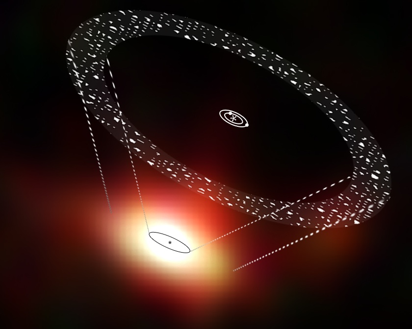
A chief goal of MESSENGER's primary mission was to understand the nature of the radar-bright deposits at the poles of Mercury. The leading proposal since the deposits were discovered has been that radar-bright material consists dominantly of frozen water ice. Scientists have never had the imagery available before to see the surface where these radar-bright features are located. But images from MESSENGER's Mercury Dual Imaging System show that all the radar-bright features near Mercury's south pole are located in areas of permanent shadow, and near Mercury's north pole such deposits are also seen only in shadowed regions.

These results are consistent with the water-ice hypothesis but not definitive proof. But the MDIS images, combined with ongoing analysis of data from MESSENGER's Neutron Spectrometer and the MLA, will provide a more complete picture of the nature of the deposits.


For more information about the MESSENGER mission, 
 NASA
Guillermo Gonzalo Sánchez Achutegui
ayabaca@gmail.com
ayabaca@hotmail.com
ayabaca@yahoo.com 

ESA - Space Science - Do missing Jupiters mean massive comet belts?


http://www.esa.int/images/GJ581_H3.jpg
Debris disc around GJ 581
Download:
 Artist impression of the debris disc and planets around the star known as Gliese 581, superimposed on Herschel PACS images at 70, 100 and 160 micrometre wavelengths.
The line drawing superimposed on the Herschel image gives a schematic representation of the location and orientation of the star, planets and disc, albeit not to scale.
The black oval outline sketched onto the Herschel data represents the innermost boundary of the debris disc; the approximate location of the outermost boundary is represented by the outer set of dashed lines. It is not possible to identify the central star due to smearing of the Herschel data.
GJ 581’s planets have masses between 2 and 15 Earth masses and are all located within 0.22 Astronomical Units (AU, where 1 AU is the distance between Earth and our Sun) of the central star. A vast debris disc extends from approximately 25 AU to 60 AU.
Background galaxies are also visible in the Herschel field-of-view. 
Credits: ESA/AOES

Using ESA’s Herschel space observatory, astronomers have discovered vast comet belts surrounding two nearby planetary systems known to host only Earth-to-Neptune-mass worlds. The comet reservoirs could have delivered life-giving oceans to the innermost planets.

In a previous Herschel study, scientists found that the dusty belt surrounding nearby star Fomalhaut must be maintained by collisions between comets.
In the new Herschel study, two more nearby planetary systems – GJ 581 and 61 Vir – have been found to host vast amounts of cometary debris.
Herschel detected the signatures of cold dust at 200ºC below freezing, in quantities that mean these systems must have at least 10 times more comets than in our own Solar System’s Kuiper Belt.
GJ 581, or Gliese 581, is a low-mass M dwarf star, the most common type of star in the Galaxy. Earlier studies have shown that it hosts at least four planets, including one that resides in the ‘Goldilocks Zone’ – the distance from the central sun where liquid surface water could exist.
Two planets are confirmed around G-type star 61 Vir, which is just a little less massive than our Sun.
The planets in both systems are known as ‘super-Earths’, covering a range of masses between 2 and 18 times that of Earth.
Interestingly, however, there is no evidence for giant Jupiter- or Saturn-mass planets in either system. 
http://www.esa.int/images/61VIR_H3.jpg
 Debris disc around 61 Vir
Download:
 Artist’s impression of the debris disc and planets around the star 61 Vir, superimposed on Herschel PACS images at 70, 100 and 160 micrometre wavelengths.
The line drawing superimposed on the Herschel image gives a schematic representation of the location and orientation of the star, planets and disc, albeit not to scale.
The black oval outline sketched onto the Herschel data represents the innermost boundary of the debris disc; the approximate location of the outermost boundary is represented by the outer set of dashed lines. It is not possible to identify the central star due to smearing of the Herschel data.
The two planets around 61 Vir have masses between 5 and 18 Earth masses and are both located within 0.22 Astronomical Units (AU, where 1 AU is the distance between Earth and our Sun) of the central star. A vast debris disc extends from approximately 30 AU to 100 AU. 
Credits: ESA/AOES

The gravitational interplay between Jupiter and Saturn in our own Solar System is thought to have been responsible for disrupting a once highly populated Kuiper Belt, sending a deluge of comets towards the inner planets in a cataclysmic event that lasted several million years.
“The new observations are giving us a clue: they’re saying that in the Solar System we have giant planets and a relatively sparse Kuiper Belt, but systems with only low-mass planets often have much denser Kuiper belts,” says Dr Mark Wyatt from the University of Cambridge, lead author of the paper focusing on the debris disc around 61 Vir.
“We think that may be because the absence of a Jupiter in the low-mass planet systems allows them to avoid a dramatic heavy bombardment event, and instead experience a gradual rain of comets over billions of years.”
“For an older star like GJ 581, which is at least two billion years old, enough time has elapsed for such a gradual rain of comets to deliver a sizable amount of water to the innermost planets, which is of particular importance for the planet residing in the star’s habitable zone,” adds Dr Jean-Francois Lestrade of the Observatoire de Paris who led the work on GJ 581.
However, in order to produce the vast amount of dust seen by Herschel, collisions between the comets are needed, which could be triggered by a Neptune-sized planet residing close to the disc.
“Simulations show us that the known close-in planets in each of these systems cannot do the job, but a similarly-sized planet located much further from the star – currently beyond the reach of current detection campaigns – would be able to stir the disc to make it dusty and observable,” says Dr Lestrade.
“Herschel is finding a correlation between the presence of massive debris discs and planetary systems with no Jupiter-class planets, which offers a clue to our understanding of how planetary systems form and evolve,” says Göran Pilbratt, ESA’s Herschel project scientist.
 Notes for Editors
 ESA
Guillermo Gonzalo Sánchez Achutegui
ayabaca@gmail.com
ayabaca@hotmail.com
ayabaca@yahoo.com

ESA Portal - Spain - Ayudando a Curiosity: Mars Express retransmite las imágenes de una roca


ESA's Mars Express relays Rocknest3 images from NASA Curiosity
 Imagen de Rocknest3 retransmitida por Mars Express
Download:
This was taken on Sol 57 (4 October 2012) of target Rocknest3 using the ChemCam Remote Micro-Imager (RMI) on the NASA Curiosity rover at a distance of 3.7 m. The image was downlinked to Earth by ESA's Mars Express orbiter via the 35m deep space ESTRACK station in New Norcia, Australia. This image was taken before a series of five ChemCam Laser-Induced Breakdown Spectrometer (LIBS) observations. Rocknest is the name of the area where Curiosity stopped for a month to perform its first mobile laboratory analyses on soil scooped from a small sand dune. Rocknest3 was a convenient nearby target of which ChemCam made more than thirty observations overall consisting of 1,500 laser shots; it was also interrogated by the arm-mounted Alpha Particle X-ray Spectrometer (APXS) instrument. 
Credits: NASA/JPL-Caltech/LANL/CNES/IRAP

Por primera vez, la sonda europea Mars Express ha retransmitido los datos científicos generados por el vehículo Curiosity de la NASA, en la superficie de Marte. Estas imágenes de ‘Rocknest3’ fueron recibidas a través de la antena de espacio profundo de la ESA en Australia.

Esta retransmisión marca un pequeño pero importante paso en la cooperación interplanetaria entre las dos agencias espaciales.
El pasado día 6 de octubre, la sonda Mars Express de la ESA apuntó su Antena de Comunicaciones con el Módulo de Aterrizaje hacia la superficie de Marte para recibir la señal enviada por Curiosity.
El vehículo de la NASA transmitió datos científicos al satélite de la ESA durante 15 minutos. Unas pocas horas más tarde, Mars Express maniobró para apuntar su antena de alta ganancia hacia la Tierra, y empezó a retransmitir la preciada información al Centro Europeo de Operaciones Espaciales en Darmstadt, Alemania, a través de la antena de 35 metros de diámetro que la ESA tiene en Nueva Norcia, Australia.  

Los datos se pusieron inmediatamente a disposición del laboratorio JPL de la NASA en California, donde fueron procesados y analizados. Una vez más, ha quedado demostrado que el nuevo vehículo de la NASA es capaz de hablar con el veterano satélite europeo.
 

El instrumento ChemCam de Curiosity estudia Rocknest3

Entre los datos retransmitidos se encontraban dos imágenes extremadamente interesantes, tomadas el 4 de octubre por el instrumento ChemCam de Curiosity.
 

ChemCam está compuesto por una cámara y por un espectrómetro de colapso inducido por láser, que dispara a un objetivo y analiza la composición química del material vaporizado.
El láser es capaz de apuntar a objetivos de menos de 1 milímetro de diámetro, sobre la superficie de rocas o del suelo marciano. El análisis espectrométrico aporta información sobre la microestructura y los minerales presentes en la roca.
ESA's Mars Express relays Rocknest3 images from NASA Curiosity
 Imagen de Rocknest3 retransmitida por Mars Express
Download:
This was taken on Sol 57 (4 October 2012) of target Rocknest3 using the ChemCam Remote Micro-Imager (RMI) on the NASA Curiosity rover at a distance of 3.7 m. The image was downlinked to Earth by ESA's Mars Express orbiter via the 35m deep space ESTRACK station in New Norcia, Australia. This image was taken after a series of five ChemCam Laser-Induced Breakdown Spectrometer (LIBS) observations. Rocknest is the name of the area where Curiosity stopped for a month to perform its first mobile laboratory analyses on soil scooped from a small sand dune. Rocknest3 was a convenient nearby target of which ChemCam made more than thirty observations overall consisting of 1,500 laser shots; it was also interrogated by the arm-mounted Alpha Particle X-ray Spectrometer (APXSI instrument. 
Credits: NASA/JPL-Caltech/LANL/CNES/IRAP
 
Una calidad de imagen excepcional

La primera imagen (al comienzo de este artículo) fue tomada antes de que ChemCam realizase una ráfaga de cinco disparos, y la segunda (a la derecha) al concluir el análisis. La imagen está centrada en el quinto punto de observación.
“La calidad de estas imágenes de ChemCam es excepcional; la combinación de las imágenes con los resultados del espectrómetro ha sido clave para la interpretación científica de los datos”, explica Sylvestre Maurice, Investigador Principal Adjunto de ChemCam en el Instituto Francés de Investigación en Astrofísica y Planetología (IRAP).
“La combinación de imágenes con los resultados de los análisis ha demostrado tener un gran potencial para su implementación en futuras misiones”.
ESA's Mars Express relays Rocknest3 images from NASA Curiosity
Objetivos del laser sobre Rocknest3
Download:
 This mosaic combines the multiple RMI images and indicates the locations of the LIBS laser observations. Credits: NASA/JPL–Caltech/LANL/CNES/IRAP/LPGN/CNRS
Los objetivos de ChemCam

Una tercera imagen, retransmitida de forma independiente por la NASA, muestra la ubicación de los objetivos de ChemCam sobre Rocknest3, vista desde la cámara RMI. El vehículo Curiosity se detuvo en el lugar bautizado como ‘Rocknest’ durante un mes para llevar a cabo sus primeros análisis de laboratorio sobre las muestras de terreno tomadas de una pequeña duna de arena. Rocknest3 era un objetivo adecuado para ChemCam, que realizó más de 30 mediciones disparando 1500 veces su láser.
 

La cámara MastCam de Curiosity tomó una imagen en gran angular para poner en contexto las observaciones de ChemCam. En ella se ve a Rocknest3, una roca de unos 10 x 40 centímetros, aproximadamente del tamaño de una caja de zapatos.
  Ayudando a Curiosity – y a otros
ESA's Mars Express relays Rocknest3 images from NASA Curiosity
 Rocknest3
Download:
Context image: The Mastcam 100 colour image shows Rocknest3 targeted by ChemCam and later by APXS; the fields of view of the RMI images are indicated. Rocknest3 is approximately 10 x 40 cm or roughly the size of a shoebox. 
Credits: NASA/JPL–Caltech/Malin Space Science Systems
 
La sonda Mars Express de la ESA también retransmitió datos de las otras misiones de la NASA sobre la superficie de Marte – Phoenix, Spirit y Opportunity – y registró la señal de Curiosity durante su llegada a Marte el pasado mes de agosto.
Durante la misión de Curiosity, está previsto que Mars Express retransmita su señal en más ocasiones, en paralelo con su propio programa de observaciones científicas, a través de un acuerdo de cooperación suscrito entre la ESA y la NASA.
Mars Express también puede proporcionar servicios de retransmisión rápidamente si los satélites de la NASA no se encontrasen disponibles o si se detectase algún problema en el vehículo.
 

Cooperación interplanetaria

“La cooperación ESA-NASA en Marte sigue siendo todo un éxito, y es posible gracias a que ambas partes han estado trabajando durante años para definir los estándares técnicos e ingenieriles que hacen posible compartir datos entre los satélites y las estaciones de seguimiento”, explica Michel Denis, Responsable de las Operaciones del Satélite Mars Express.
“La exploración de Marte es un gran reto. Para afrontarlo, las agencias espaciales están trabajando para impulsar la cooperación y el apoyo mutuo en las misiones actuales y venideras. Es como se hará en el futuro”. 
ESA
Guillermo Gonzalo Sánchez Achutegui
ayabaca@gmail.com
ayabaca@hotmail.com
ayabaca@yahoo.com 

NASA - Centaur, A NASA Workhorse


Workers at the Propulsion Systems Laboratory at Lewis Research Center, now John H. Glenn Research Center, develop the Centaur upper stage rocket. The Centaur was an ambitious rocket using liquid oxygen and liquid hydrogen.

Download Image

› Full Size
Guillermo Gonzalo Sánchez Achutegui
ayabaca@gmail.com
ayabaca@hotmail.com
ayabaca@yahoo.com

domingo, 25 de noviembre de 2012

Doha: una cumbre sin expectativas en acuerdos climáticos

Hola amigos: AL VUELO DE UN QUINDE EL BLOG.,  hay una escalofriante desconfianza en los países participantes en la Conferencia del Clima de Doha, por los sucesivos fracasos en las anteriores conferencias donde los asistentes muchas veces gobernantes que comprometen su voto por el Cambio Climático, pero llegando a su país de origen se olviden, todo lo pactado; esto sucede por que hasta ahora no hay un VOTO VINCULANTE  para cumplir los compromisos y nunca se hará por que los más interesados en que no pase nada como :  Los estados Unidos de América, China, India y algunos de las potencias europeas no tienen intenciones de reducir las emisiones del  Dióxido de Carbono(CO2), ojalá en esta ocasión hay algo interesante aunque nosotros somos muy escépticos.

La secretaria de Estado española de Cambio Climático señaló la necesidad de cumplir los compromisos internacionales y la necesidad de trabajar juntos para consolidar la referencia común del coste del CO2. EFE/Archivo

Madrid, 25 nov (EFEverde).- La conferencia anual de cambio climático, que despega mañana en Doha (Catar), comienza con posiciones alejadas entre los países y sin expectativas de alcanzar acuerdos vinculantes para reducir las emisiones más contaminantes que involucren a economías desarrolladas y emergentes.

Se trata de una cumbre con un perfil bajo, donde se van a tratar a priori temas colaterales, ya que desde Copenhague (2009) se perdió la oportunidad de alcanzar un acuerdo vinculante con objetivos cuantitativos y plazos que diera continuidad al Protocolo de Kioto.
Así lo explica en una entrevista con EFEVerde el físico y jefe del Área de Evaluación y Modelización del clima de la Agencia de Meteorología (Aemet), Ernesto Rodríguez Camino, para quien es difícil "prejuzgar" lo que ocurrirá durante la cumbre aunque dependerá de China y Estados Unidos, grandes emisores de CO2.
Sobre la mesa de estas conferencias y a partir de Copenhague se ponen "cuestiones menores" como la reforestación o la deforestación evitando bucear en el meollo de las reducciones de los gases, afirma el experto.
La XVIII Cumbre de la ONU sobre Cambio Climático (COP18) persigue acercar posiciones sobre la extensión del Protocolo de Kioto, que expira a finales de año, y su sustitución en 2015 por un nuevo acuerdo global sobre la reducción de gases de efecto invernadero que debe entrar en vigor en 2020.
Estados Unidos -recuerda el experto en Clima- no firmó el Protocolo y China ha pasado de ser un país considerado en vías de desarrollo y sin obligaciones para limitar sus reducciones, a ser uno de los motores de las emisiones de CO2.
Por eso, asegura Rodríguez, es de suma importancia que las economías emergentes controlen los gases que emiten a la atmósfera, ya que de no ser así, el problema se puede escapar de las manos.
"Si no hay un esfuerzo definitivo, global y compartido para controlar las emisiones será difícil soportar aumentos de temperatura por encima de los 2 centígrados sobre el nivel preindustrial, causa probable de grandes trastornos sociales y medioambientales".
Para el experto, las emisiones siguen aumentando sin indicios de que empiecen a decaer, ya que a su juicio es un tema muy complicado ligado a la economía.
"Ningún país quiere poner en riesgo su crecimiento económico y energético por compromisos ambientales", asevera Rodríguez Camino.
En España, los planes para reducir emisiones han coincidido con una situación económica marcada por la crisis actual, causa destacada en la mitigación de gases ya que los planes marcados por el ejecutivo son insuficientes y muy alejados de las disposiciones de otros países europeos.
Quizá, argumenta el físico, haya sido un intento por parte del Gobierno de no poner en peligro el crecimiento económico.
A su juicio, las emisiones de gases de efecto invernadero (GEI) son un problema cuya solución hay que buscarla en lo económico, energético y tecnológico.
Si hubiese una tecnología capaz de producir energía, tan barata como los combustibles fósiles y que no emitiese CO2, el problema estaría resuelto apostilla Rodríguez, pero dicha fuente no existe y otras alternativas como las energías renovables necesitan ser estimuladas.
La conferencia sobre Cambio Climático de Doha (Catar) se desarrollará entre el 26 de noviembre y el 7 de diciembre, y está previsto que asistan más de 100 ministros de países de los cinco continentes.
EFEverde
Guillermo Gonzalo Sánchez Achutegui
ayabaca@gmail.com
ayabaca@hotmail.com
ayabaca@yahoo.com

Cambio Climático: Catar se prepara para acoger la cumbre mundial sobre cambio climático


http://upload.wikimedia.org/wikipedia/commons/e/ee/Doha_construction.jpg
Edificios en la Corniche. Wikipedia.
http://upload.wikimedia.org/wikipedia/commons/f/fc/Doha_montage.jpg
Doha (árabe: دوحة, Ad-Dawhah; la trascripción Doha corresponde a la pronunciación árabe dialectal) es la capital de Catar, país situado en una pequeña península en el golfo Pérsico. Su población estimada es de 998.651 habitantes (2009) y las principales actividades económicas son la industria del petróleo y la pesca. Cerca de Doha se encuentra la Ciudad de la Educación, zona dedicada a la investigación y la educación. La posición geográfica de Doha corresponde a las coordenadas 25.3° N 51.5333° E.
Doha fue en 2001 la sede de la primera reunión a nivel ministerial de la Ronda de Doha, esto es las negociaciones de la Organización Mundial de Comercio con el propósito de liberalizar el comercio mundial.
La ciudad cuenta con un aeropuerto, el Aeropuerto Internacional de Doha y pronto se inaugurará el Nuevo Aeropuerto Internacional de Doha.
En la ciudad se encuentra la sede de la cadena de televisión Al-Yazira, uno de los principales medios de comunicación internacionales en lengua árabe. En el 2022, será sede de la Copa del Mundo de Fútbol en Catar. El Estadio Nacional de Lusail, el más grande de todos, será la sede de entre otros encuentros, el partido inaugural y la final.
Wikipedia.

 Fotografía: recurso de archivo del fenómeno de El Niño
 El Centro de Predicciones Climáticas (CPC) de Estados Unidos espera que el fenómeno del "El Niño" sea "débil" durante el invierno del hemisferio norte, aunque no descarta la posibilidad de que se fortalezca. En la foto de 2009, un niño lleva agua a su casa bajo una lluvia torrencial en Paranaque, al sur de Manila (Filipinas).  EFE/FRANCIS R. MALASIG

 Doha, 25 nov (EFEverde).- La Cumbre de Naciones Unidas sobre el Cambio Climático arranca mañana en Catar con el objetivo de evaluar los avances de los distintos países en la reducción de las emisiones de gases de efecto invernadero.
 Doha se prepara para acoger la mayor cumbre de su historia con con la participación de cerca de 17.000 personas procedentes de 194 países.
Entre los asistentes, habrá más de 7.000 miembros de organizaciones no gubernamentales, tanto ecologistas, como dedicadas a la conservación, el desarrollo social, la juventud y la mujer, además de unos 2.500 voluntarios residentes en este pequeño emirato del golfo Pérsico.
Unos 1.500 periodistas, de medios de comunicación locales e internacionales, se han acreditado para cubrir las reuniones que se desarrollarán entre el 26 de noviembre y el 7 de diciembre.
La conferencia comenzará mañana con un acto de bienvenida conducido por el presidente de la Autoridad Administrativa de Control y Transparencia de Catar, Abdulá bin Hamad al Atiya, que presidirá esta cumbre, la primera sobre cambio climático que se celebra en Oriente Medio.
Entre las prioridades de la agenda, está la evaluación de los progresos de los países en la reducción de emisiones de gases de efecto invernadero en el marco del Protocolo de Kioto, cuyo primer período de compromiso termina el 31 de diciembre de 2012.
La cumbre tendrá lugar en el Centro Nacional de Convenciones de Catar, que pondrá a disposición de los participantes todos sus espacios y salas de reuniones, incluyendo 40.000 metros cuadrados de superficie de exposición cubierta y 3.500 metros de exposición al aire libre, equivalente a casi 10 campos de fútbol.
El Ministerio catarí del Interior ha puesto en marcha un plan integral para garantizar la seguridad durante el evento, que será a la vez amplia y discreta.
Las fuerzas de seguridad están preparadas para cualquier eventualidad y proporcionarán apoyo a todos los acontecimientos vinculados a la conferencia, entre ellos una muestra sobre sostenibilidad que se celebrará simultáneamente en el Centro de Exhibiciones de Doha.
Entre las organizaciones presentes estará Greenpeace, que ha anunciado que no convocará protestas en Doha, al no contar con una delegación fija en la ciudad.
La organización, conocida por sus protestas en otras cumbres, como la de 2011 en Sudáfrica, ve la celebración de la cumbre en la capital catarí como una oportunidad para obtener más fondos para financiar la lucha contra el cambio climático.
Catar es el país con más emisiones de CO2 por habitante, al superar las 50 toneladas, por delante de EEUU, con 20, y la Unión Europea, con unas 10.
No obstante, entre sus objetivos de cara a 2030 -recogidos en el documento Qatar National Vision 2030, publicado en 2008-, se encuentra transformar "una sociedad basada en el carbono, en una sociedad basada en el conocimiento".
El país, cada vez más presente en la escena internacional, depende casi al 100 % del mar para obtener agua y casi del 95 % de la tecnología y el comercio para obtener alimentos.
Es también uno de los 10 países en vías de desarrollo que se prevé resulten más afectados por la subida del nivel del mar.EFE
 Guillermo Gonzalo Sánchez
ayabaca@gmail.com
ayabaca@hotmail.com
ayabaca@yahoo.com

domingo, 18 de noviembre de 2012

ESA Portal - GOCE’s second mission improving gravity map


http://www.esa.int/images/PerformanceImprovements_H.jpg

Download:
The image on the left shows GOCE’s gravity measurements over northern Europe, acquired from its previous altitude. The image on the right depicts the expected measurements over the same area after the satellite has been lowered by 15 km. An increased signal and improved spatial resolution is evident. 
Credits: ESA / GOCE+ Theme 2
Download:
 The need for GOCE (Gravity Field and Steady-State Ocean Circulation Explorer) to fly in a low orbit means it has to be equipped with a system to compensate for the atmospheric drag it will experience at this exceptionally low altitude. The animation shows a close-up of the ion-propulsion assembly, which keeps the satellite in a smooth trajectory – free from all effects except the gravity field itself. Two winglets provide additional aerodynamic stability. 
Credits: ESA/AOES Medialab
ESA’s GOCE gravity satellite has already delivered the most accurate gravity map of Earth, but its orbit is now being lowered in order to obtain even better results.

The Gravity field and steady-state Ocean Circulation Explorer (GOCE) has been orbiting Earth since March 2009, reaching its ambitious objective to map our planet’s gravity with unrivalled precision.
Although the planned mission has been completed, the fuel consumption was much lower than anticipated because of the low solar activity over the last two years. This has enabled ESA to extend GOCE’s life, improving the quality of the gravity model.
To be able to measure the strength of Earth’s gravity, the satellite was flying in an extraordinarily low orbit about 255 km high – about 500 km lower than most Earth observation satellites.
Based on a clear preference from the GOCE user community, ESA’s Earth Scientific Advisory Committee recommended lowering the orbit to 235 km starting in August. 
Lowering the orbit increases the accuracy and resolution of GOCE’s measurements, improving our view of smaller ocean dynamics such as eddy currents. The control team began the manoeuvres in August, lowering GOCE by about 300 m per day.
After coming down by 8.6 km, the satellite’s performance and new environment were assessed. Now, GOCE is again being lowered while continuing its gravity mapping. Finally, it is expected to reach 235 km in February.
As the orbit drops, atmospheric drag increasingly pulls the satellite towards Earth. But GOCE was designed to fly low, the tiny thrust of its ion engine continuously compensating for any drag.
The expected increase in data quality is so high that scientists are calling it GOCE’s ‘second mission.’
Download:
 HI-RES JPEG (Size: 6044 kb
 ESA's GOCE mission has delivered the most accurate model of the 'geoid' ever produced, which will be used to further our understanding of how Earth works.
The colours in the image represent deviations in height (–100 m to +100 m) from an ideal geoid. The blue colours represent low values and the reds/yellows represent high values.
A precise model of Earth's geoid is crucial for deriving accurate measurements of ocean circulation, sea-level change and terrestrial ice dynamics. The geoid is also used as a reference surface from which to map the topographical features on the planet. In addition, a better understanding of variations in the gravity field will lead to a deeper understanding of Earth's interior, such as the physics and dynamics associated with volcanic activity and earthquakes. 
Credits: ESA/HPF/DLR

“For us at ESA, GOCE has been a fantastic mission and it continues to surprise us,” said Volker Liebig, ESA’s Director of Earth Observation Programmes.
“What the team of ESA engineers is now doing has not been done before and it poses a challenge. But it will also trigger new research in the field of gravity based on the high-resolution data we are expecting.”
The first ‘geoid’ based on GOCE’s gravity measurements was unveiled in June 2010. It is the surface of an ideal global ocean in the absence of tides and currents, shaped only by gravity.
A geoid is a crucial reference for conducting precise measurements of ocean circulation, sea-level change and ice dynamics.
The mission has also been providing new insight into air density and wind in space, and its information was recently used to produce the first global high-resolution map of the boundary between Earth’s crust and mantle.
  ESA
Guillermo Gonzalo Sánchez Achutegui
ayabaca@hotmail.com
ayabaca@gmail.com
ayabaca@yahoo.com

ESA - Space Science - Snap the stars to see your photo on ESA portal


Transit of Venus as seen from Canberra, Australia
Download:
Transit of Venus as seen from Canberra, Australia, 2012. 
Credits: Manuel Castillo-Fraile and Miguel Sánchez-Portal

Have you taken an interesting astronomical photo this year? From planets and moons to the Sun, stars and galaxies, we’d like you to send us your images to feature as our Space Science Image of the Week on 31 December.

The ESA Space Science team’s favourite image will take the slot of our weekly image during the week beginning 31 December 2012 as a celebration of the astronomical events of the year gone by. The best of the rest will feature in our dedicated ESA Space Science images Flickr gallery. During 2012, the sky has staged a series of astronomical theatrics to provide plenty of inspiration for your entry. Perhaps you were lucky enough to observe a solar eclipse, or even the transit of Venus. Maybe you snapped a meteor streaking through the sky, or perhaps you found beauty in the constellations this year. Images of galaxies and nebulae are also welcomed. 
 

Totality
Download:
The total solar eclipse of 13/14 November 2012. The clouds cleared in time for observers at Palm Cove, Australia, to experience totality as the Moon totally obscured the Sun for around two minutes, revealing the Sun's bright corona. 
Credits: Anik De Groof

If you would like to participate but have yet to capture the perfect image, here are some upcoming events to spark some ideas:
17/18 November: Leonids meteor shower – watch ‘shooting stars’ rain from the constellation of Leo this weekend as Earth bumps into debris from Comet Tempel-Tuttle.
27 November: conjunction between Venus and the ringed planet Saturn – the two planets meet to within 1º before sunrise for European observers. With an unobstructed horizon, you may also glimpse Mercury.
28 November: penumbral lunar eclipse – watch the Moon enter Earth’s faint outer shadow (beginning 12:14 GMT and ending 16:51 GMT)
3 December: Jupiter at opposition – the gas giant will be at its closest approach to Earth with its face fully illuminated by the Sun, providing ideal conditions to view and photograph the planet with its four Galilean moons.
 We invite you to photograph these events – or review your images taken during 2012 – and submit your best shot to scicom@esa.int by Monday 10 December. Images will be judged mainly on their aesthetic value.
Amateur photographers and astronomers from around the world are encouraged to participate.
Please include your name, contact email address, your geographical location, the date you took the image, the camera/telescope you used, and any imaging/processing details that you would like to share.
The image must have been taken in 2012 and only one entry per person, please.
ESA
Guillermo Gonzalo Sánchez Achutegui
ayabaca@gmail.com
ayabaca@hotmail.com
ayabaca@yahoo.com

jueves, 15 de noviembre de 2012

nsf.gov - News - Climate Change Threatens Giant Pandas’ Bamboo Buffet--and Survival

China’s endangered wild pandas may need new dinner reservations--and quickly, based on models that indicate climate change may kill off swaths of bamboo that pandas need to survive
This panda is one of about 275 wild Qinling pandas that live in the study region. Their isolation has resulted in genetic variation from other giant pandas. Some of these pandas, like the one shown here, are brownish.
Credit: Yange Yong
Download the high-resolution JPG version of the image. (1.6 MB)
Because bamboo is very low in nutrients, wild pandas eat as much as 84 pounds of bamboo daily, and spend at least 12 hours per day eating bamboo. A wild panda may also occasionally eat other grasses and small rodents or musk deer fawns.
Credit: Andrés Viña, Michigan State University Center for Systems Integration and Sustainability
Download the high-resolution JPG version of the image. (526 KB)
A bamboo trove in western China.
Credit: Andrés Viña, Michigan State University Center for Systems Integration and Sustainability
Download the high-resolution JPG version of the image. (1.8 MB)

In this week's Nature Climate Change, an international journal, scientists from Michigan State University (MSU) and the Chinese Academy of Sciences provide comprehensive forecasts of how changing climate may affect the most common species of bamboo that carpet the forest floors of prime panda habitat in northwestern China. Even the most optimistic scenarios show that bamboo die-offs would effectively cause prime panda habitat to become inhospitable by the end of the 21st century.
The scientists studied possible scenarios of climate change in the Qinling Mountains in Shaanxi Province. At the northern boundary of China's panda distributional range, the Qinling Mountains are home to about 275 wild pandas, which account for about 17 percent of the remaining wild population. The Qinling pandas, which have been isolated because of thousands of years of human habitation around the mountain range, vary genetically from other giant pandas. The geographic isolation of these pandas makes them particularly valuable for conservation, but vulnerable to climate change.
"Understanding impacts of climate change is an important way for science to assist in making good decisions," said Jianguo "Jack" Liu, director of MSU's Center for Systems Integration and Sustainability (CSIS) and a study co-author. "Looking at the climate impact on the bamboo can help us prepare for the challenges that the panda will likely face in the future."
Bamboo is a vital part of forest ecosystems, being not only the sole menu item for giant pandas, but also providing essential food and shelter for other wildlife, including other endangered species like the ploughshare tortoise and purple-winged ground-dove.
Bamboo can be a risky crop to stake survival on because it has an unusual reproductive cycle. The studied species only flower and reproduce every 30 to 35 years, which limits the plants' ability to adapt to changing climate and can spell disaster for a food supply.
Mao-Ning Tuanmu, who recently finished his Ph.D. studies at CSIS, and his colleagues constructed unique models, using field data on bamboo locality, multiple climate projections and historic data of precipitation, temperature ranges and greenhouse gas emission scenarios to evaluate how three dominant bamboo species would fare in the Qinling Mountains of China.
Not many scientists to date have studied understory bamboo, Tuanmu said. But evidence found in fossil and pollen records does indicate that bamboo distribution has followed the benefits--and devastation--of climate change over time.
The fate of pandas will not only be determined by nature, but by humans as well. If, as the study's models predict, large swaths of bamboo become unavailable because of human-caused land use changes, pandas will be deprived of clear, accessible paths between meal sources.
"The giant panda population also is threatened by other human disturbances," Tuanmu said. "Climate change is only one challenge for the giant pandas. But on the other hand, the giant panda is a special species. People put a lot of conservation resources into them compared to other species. We want to provide data to guide that wisely."
The models can point the way for proactive planning to protect areas where the climate increases their potential for providing adequate food sources or to begin creating natural "bridges" to allow pandas an escape hatch from bamboo famine.
"We will need proactive actions to protect the current giant panda habitats," Tuanmu said. "We need time to look at areas that might become panda habitat in the future, and to think now about maintaining connectivity of areas of good panda habitat and habitat for other species. What will be needed is speed."
In addition to Tuanmu, who now is a postdoctoral researcher at the Department of Ecology and Evolutionary Biology at Yale University, the paper, "Climate change impacts on understory bamboo species and giant pandas in China's Qinling Mountains" was authored by Andrés Viña, assistant professor of fisheries and wildlife and a CSIS member; Julie Winkler, MSU geography professor; Yu Li, a research assistant and CSIS alumnus, and Zhiyun Ouyang and Weihua Xu, director and associate professor of the State Key Laboratory of Urban and Regional Ecology, Research Center for Eco-Environmental Sciences, Chinese Academy of Sciences.
The research was funded by the National Science Foundation and NASA as well as supported by MSU AgBioResearch.
-NSF-
Media Contacts Whiteman Lily, National Science Foundation (703) 292-8310 lwhitema@nsf.gov
Sue Nichols, Michigan State University (517) 432-0206 nichols@msu.edu
The National Science Foundation (NSF) is an independent federal agency that supports fundamental research and education across all fields of science and engineering. In fiscal year (FY) 2012, its budget is $7.0 billion. NSF funds reach all 50 states through grants to nearly 2,000 colleges, universities and other institutions. Each year, NSF receives over 50,000 competitive requests for funding, and makes about 11,000 new funding awards. NSF also awards nearly $420 million in professional and service contracts yearly.
Useful NSF Web Sites:
NSF Home Page: http://www.nsf.gov
NSF News: http://www.nsf.gov/news/
For the News Media: http://www.nsf.gov/news/newsroom.jsp
Science and Engineering Statistics: http://www.nsf.gov/statistics/
Awards Searches: http://www.nsf.gov/awardsearch/
The National Science Foundation (NSF) .
Guillermo Gonzalo Sánchez Achutegui
ayabaca@gmail.com
ayabaca@hotmail.com
ayabaca@yahoo.com

martes, 13 de noviembre de 2012

NASA - Sheldon Glacier


Download Image

› Full Size 
 NASA
Guillermo Gonzalo Sánchez Achutegui
ayabaca@gmail.com
ayabaca@hotmail.com
ayabaca@yahoo.com

ESA Portal - Spain - ¡Prepárense para un eclipse total de Sol!


Corona solar durante un eclipse
Download:
Composite image from Proba-2’s SWAP imager (with 174Å filter) showing the Sun’s disc, with a reconstructed white-light image of the extended corona taken at exactly the same time from the ground, during the total solar eclipse observed in July 2010 in Atoll Hao, French Polynesia. 
Credits: ESA/Proba-2 consortium/SWAP team/Institut d’Astrophysique de Paris (CNRS & UPMC), S. Koutchmy/J. Mouette

El eclipse solar de mañana solo será visible en su totalidad para observadores basados en tierra que se encuentren en el norte de Australia, pero el satélite de observación solar de la ESA, Proba-2, tendrá un asiento de primera fila desde su órbita alrededor de la Tierra.

Durante un eclipse total de Sol, la Luna se mueve entre el Sol y la Tierra. Su separación y alineamiento hacen que la Luna parezca lo suficientemente grande como para bloquear temporalmente la luz del Sol.
Una luz fantasmagórica se cierne sobre los observadores a medida que el imponente y oscuro disco de la Luna reemplaza brevemente la brillante cara del Sol.
La totalidad – cuando el Sol está completamente oscurecido – tundra lugar mañana a las 22:11:48 GMT sobre el Pacífico Sur durante cuatro minutos y dos segundos.
Los observadores de la costa este de Queensland, Australia, serán de los pocos afortunados que podrán ver el eclipse total, disfrutando la totalidad durante unos dos minutos, ya que el Sol se encuentra a unos 14 grados sobre horizonte.
Durante la totalidad, el Sol parece tener un halo blanco – una fugaz y extraña visión de la atmósfera de plasma –la corona- a millones de grados de temperatura, algo que normalmente suele estar oculto por el propio brillo del Sol a los ojos de un observador.
En la imagen mostrada, obtenida por el satélite Proba-2, vemos el disco solar durante el eclipse total de Julio de 2010, combinada con imágenes tomadas desde tierra y obtenidas en el mismo instante con el fin de revelar detalles muy precisos de la corona solar.
Una instantánea del siempre cambiante entorno del campo magnético del Sol expuesto momentáneamente con torrentes de plasma lanzados al espacio, junto con prominencias solares vistas muy cerca del extremo del disco solar.
Durante el evento de mañana, Proba-2 cruzará la sombra de la Luna varias veces, obteniendo tres eclipses solares parciales y sus órbitas alrededor de la Tierra. En el momento del eclipse total visto desde Australia, sin embargo, Proba-2 verá el disco solar completo, ofreciendo una oportunidad idónea para comparar la corona solar vista desde tierra con observaciones del Sol desde el espacio.
El instrumento SWAP instalado en el satélite monitorizará el Sol en luz ultravioleta, mientras que el instrumento LYRA medirá la energía emitida por el Sol, que será menos intensa a medida que el sol se vaya oscureciendo.
Por favor, tengan cuidado si tienen la suerte de poder observar este eclipse: mirar al Sol sin protección en los ojos es extremadamente peligroso y puede causar ceguera permanente. Utilicen equipos que hayan sido certificados, como gafas para eclipses de Sol, o telescopios solares bajo supervisión profesional  
ESA
Guillermo Gonzalo Sánchez Achutegui
ayabaca@gmail.com
ayabaca@hotmail.com
ayabaca@yahoo.com

lunes, 12 de noviembre de 2012

CAMBIO CLIMÁTICO: El Ártico, el nuevo El Dorado


Foto  de archivo del glaciar Humboldt, en Groenlandia. EFE/GREENPEACE/Nick Cobbing.

Madrid, 11 nov (EFE).- El Ártico es una gran masa de hielo rodeada de naciones, algunas las más grandes del mundo. Rusia, EE.UU, Canadá, Noruega y Dinamarca negocian sus límites fronterizos con esas aguas para realizar prospecciones, en las que se cree yace el 13 % del petróleo y el 30 % de las reservas de gas inexploradas.

Recientemente se ha confirmado lo que se venía venir desde hace años: un deshielo catastrófico en el Océano Ártico. El pasado mes de julio, científicos estadounidenses observaron que la superficie de Groenlandia afectada por el deshielo pasó de un 40 por ciento, cifra habitual, a más de un 90 por ciento, extensión récord en tan solo cuatro días.
Los últimos veranos el deshielo ha permitido ver por primera vez que dos míticos pasos nunca antes utilizables, el del Noroeste y el del Noreste, que permiten ir del Atlántico al Pacífico por el norte de Canadá y el norte de Siberia respectivamente, ya lo han sido.
Para el investigador microbiólogo, Carlos Pedrós Alió, del Instituto de Ciencias del Mar de Barcelona, perteneciente al Consejo Superior de Investigaciones Científicas (CSIC), "a medida que se calienta el Ártico cada vez hay menos hielo".
Y por esto, las zonas que están próximas a la costa empiezan a estar abiertas todos los veranos, es decir, que se puede navegar, y es ahí donde se encuentran las plataformas continentales, donde se cree que está la mayor parte de las reservas de petróleo.

LOS RIESGOS PARA ENCONTRAR PETRÓLEO

Pero el petróleo tiene en el mar un historial salpicado de sucesos dramáticos, cuyas consecuencias en muchos casos todavía permanecen alterando el medio ambiente. Así, como explicó el investigador, "el problema está en que siempre que se realiza una intervención de este tipo existen riesgos de que haya accidentes, como se ha comprobado".
Como dijo Pedrós Alió, las empresas hacen un cálculo para el caso que haya un accidente, y consideran los medios que habrá que utilizar para limpiar la zona.
El problema está en que el único interés de la empresa es obtener beneficios, no preservar el medio ambiente. Por tanto, es obligación de las administraciones asegurarse de que el plan de limpieza esté bien hecho.
El accidente de la plataforma del Golfo de México que se incendió en 2010, demostró a los científicos algo muy importante: que aunque "ésta es una zona cálida, accesible y situada en uno de los países más desarrollados del mundo, sin embargo ocasionó todos los problemas medioambientales".
Y, por ellos, "la empresa (BP) va a tener que pagar cerca de 40.000 millones de dólares, además de lo que van a tener que pagar los contribuyentes por lo que habrá que hacer en adelante", subrayó el investigador.
"En el Ártico estas situaciones se complican mucho -continuó Pedrós- porque no hay experiencia y las compañías no están preparadas para solucionar un accidente si se produce en medio de una tempestad o en la oscuridad que hay en uno o dos meses, o bien si llegan placas de hielo con capacidad de romper las plataformas o las conducciones de petróleo".
El investigador sostuvo que, aunque los efectos serían los mismos que en cualquier otro lugar, el problema es que "el petróleo tiene compuestos volátiles y compuestos que flotan que pueden matar todo lo que se encuentra debajo. A la fauna de la costa, aves o mamíferos, estos compuestos les hacen perder el aislamiento térmico y, además, a las aves les impide volar, por lo que en una zona tan fría mueren enseguida unos y otros. La economía de las poblaciones que viven cerca del mar también queda destrozada. Así pues, los efectos son tanto para las aguas como para los ecosistemas y las poblaciones humanas en general".

LAS LAGUNAS DE LA LEY

Consideró el científico español que "resulta lógico que países como Noruega o Rusia, que tienen acceso a una gran zona de la plataforma ártica con grandes posibilidades de petróleo quieran explotarlo. Lo que ocurre es que hay que encontrar un equilibrio entre ese deseo de riqueza y las consecuencias que pueda tener su extracción".
Los destrozos que pueda haber en esa zona tan sensible son enormes y pueden perdurar por mucho tiempo o, incluso, ser definitivos.
Por eso, dijo Pedrós Alió, "alguien tiene que vigilar que las empresas lo hagan bien y que los estados cumplan unos requisitos mínimos" y afirmó que Canadá lo ha hecho de una forma muy cuidadosa porque posee muchísima costa en el Ártico.
Es distinta la actitud de países como Noruega o Rusia que carecen de poblaciones en esa zona, por lo que, como señaló el investigador, "la economía prima más que el bienestar de las personas".
Pero la legislación en este terreno es pobre y confusa. El profesor de investigación en el departamento de Recursos Naturales del Instituto Mediterráneo de Estudios Avanzados, centro mixto del CSIC y la Universidad de Baleares, Carlos Duarte, explicó la situación en la que se encuentran los países en litigio.
Los países que reivindican territorialidad están, desde hace tiempo, ocupados en desarrollos mineros y de gas y petróleo. Lo sorprendente es que "algunos gobiernos estén reabriendo esas minas de carbón que tras décadas estaban cerradas, debido a los enormes impactos que la emisión de metales pesados asociada a estas explotaciones causaron sobre la fauna y las personas en el Ártico", afirmó.
Otros muchos países lejanos están también implicados en la explotación. Australia, casi en las antípodas de Groenlandia, ha pedido el 40 % de las 200 solicitudes.
En referencia a las leyes internacionales, que establecen las limitaciones territoriales, Duarte explicó que "las leyes internacionales, en particular UNCLOS (UN Law of the Sea) fija 200 millas desde la línea de costa como aguas económicas exclusivas".
Sin embargo, dijo Duarte, "existe una provisión por la que los países que aporten evidencias de que su plataforma costera se extiende más allá de estas 200 millas pueden solicitar una ampliación del límite".
Todos los países con territorio en el Ártico están actualmente implicados en estas solicitudes, de forma que "las aguas internacionales del Océano Glaciar Ártico podrían, de aceptarse estas reclamaciones, quedarse en menos del 10% de la superficie de este océano", concluyó Duarte.
EFE
Guillermo Gonzalo Sánchez Achutegui
ayabaca@gmail.com
ayabaca@hotmail.com
ayabaca@yahoo.com

ESA - Technology - Get ready for a total solar eclipse!


Solar eclipse corona
Download:
Composite image from Proba-2’s SWAP imager (with 174Å filter) showing the Sun’s disc, with a reconstructed white-light image of the extended corona taken at exactly the same time from the ground, during the total solar eclipse observed in July 2010 in Atoll Hao, French Polynesia. 
Credits: ESA/Proba-2 consortium/SWAP team/Institut d’Astrophysique de Paris (CNRS & UPMC), S. Koutchmy/J. Mouette

Tomorrow’s total solar eclipse will only be visible in its entirety to ground-based observers watching from northern Australia, but ESA’s Sun-watching Proba-2 satellite will have a ringside seat from its orbit around Earth.

During a total solar eclipse the Moon moves in front of the Sun as seen from Earth, their separation and alignment such that the Moon appears large enough to temporarily block out the Sun’s light.
An eerie light is cast over ground observers as the imposing black disc of the Moon briefly replaces the Sun’s bright face.
Totality – when the Sun is completely obscured – occurs tomorrow at 22:11:48 GMT over the South Pacific for four minutes and two seconds.
Observers along the east coast of Queensland, Australia, will be the lucky few to see the total eclipse, enjoying totality for about two minutes as the Sun rises 14 degrees above the horizon.
During totality the Sun appears to have a white halo – a rare glimpse of the Sun’s million-degree plasma atmosphere, or corona, which is too washed out by the Sun’s brightness to be observed normally. 
Flying in a 720 km orbit, Proba-2 is the second in ESA's Project for Onboard Autonomy series, capable of flying itself with minimal support from the ground. Its purpose is flight-test new technologies and it carries a total of 17 technology payloads. It also carries four scientific instruments focused on the Sun and space weather.

In the image presented above, a Proba-2 image of the solar disc taken during the total eclipse of July 2010 is combined with ground-based images taken at the same time to reveal the exquisite details of the solar corona.
A snapshot of the ever-changing environment of the Sun’s magnetic field is momentarily exposed with plasma streaming out into space, alongside looping prominences seen much closer to the edge of the solar disc.
During tomorrow’s event Proba-2 will pass through the Moon’s shadow several times, catching three partial solar eclipses as it orbits around Earth. At the time of the total eclipse seen from Australia, however, Proba-2 will see the full solar disc, providing an ideal opportunity to compare the solar corona from the ground with observations of the Sun from space.
The satellite’s SWAP instrument will monitor the Sun in extreme ultraviolet light, while LYRA will measure solar output, which will become less intense as more of the Sun is obscured.
Please take care if you are lucky enough to be observing this event: observing the Sun with the naked eye is extremely dangerous and will cause permanent blindness. Please use certified equipment such as solar eclipse glasses, or a solar telescope under professional guidance. 
ESA
Guillermo Gonzalo Sánchez Achutegui
ayabaca@gmail.com
ayabaca@hotmail.com
ayabaca@yahoo.com 

domingo, 4 de noviembre de 2012

De la muerte negra a... la muerte verde


Madrid, 30 oct (EFEverde).- El concepto de muerte en las sociedades occidentales ha tenido tradicionalmente una connotación oscura o negra, sin embargo los cambios sociales han hecho que la conciencia ecológica llegue también a la industria funeraria, donde "pasar al otro lado" adquiere cada vez un color más verde.

Urnas de sal marina, de tierra, o féretros elaborados con almendras, cartón y resinas naturales, son algunas de las alternativas de entierro o incineración ecológica que se vienen adoptando desde hace cinco años, tiempo en el que la conciencia ambiental se ha introducido en el sector funerario.
Ecofunerales
De esta conciencia, nace el concepto de "Ecofuneral", etiqueta que se acuñó el año pasado para referirse a los entierros que pretenden reducir el impacto ambiental, ha indicado a Efeverde el director general del grupo funerario Mémora, Eduard Vidal.
Porque "morirse contamina", ha apuntado Vidal, y lo hace desde el propio cadáver, que desprende "lixiviados" o líquidos, hasta los métodos funerarios que se emplean, como la cremación, que lanza gases dañinos para la atmósfera.
Según datos de la Asociación Nacional de Servicios Funerarios (PANASEF), las cremaciones superan a la inhumaciones y se estima que en España alrededor de un 32 % de fallecidos son reducidos a cenizas.
Para evitar esta emisión de gases, los féretros ecológicos están fabricados con madera reciclada, no llevan ningún tipo de herraje metálico y el barniz que cubre la madera es en base agua, y no en base disolvente, que es lo que contamina al arder.
Filtros especiales
Además, una ley de 2002 obliga a la evaluación del impacto ambiental de los hornos crematorios, que cada vez son más sofisticados y disponen de filtros especiales que consiguen generar "una emisión limpia", sostiene Vidal.
Y a la hora de guardar las cenizas, otros artículos optan por "reconciliarse con la naturaleza", comenta la responsable comercial de la empresa fabricante de urnas biodegradables Limbo, Tania Inzunza, porque la urna hecha en base a sal marina está pensada para arrojarla al mar y la de tierra para enterrarla e introducir una semilla que dé lugar al crecimiento de un árbol.
Coches fúnebres eléctricos
La oferta verde también llega a la movilidad y muchas empresas funerarias como Mémora ya utilizan coches fúnebres eléctricos.
Otras novedades del sector funerario van encaminadas a dar a los cementerios un aspecto alegre, colorido y con jardines frente al tono oscuro y tétrico que siempre caracteriza estos lugares.
"Ahora se tiende a crear espacios para pasear y rendir homenaje a los difuntos", ha apuntado Jesús Pozo, director de la revista 'Adiós', que edita Funespaña.
Es el caso del cementerio Sur de Madrid, donde se está llevando a cabo la construcción de un edificio crematorio y un espacio verde destinado a columbarios para crear un moderno "jardín del recuerdo".
En lo económico, un funeral respetuoso con el medio ambiente es "un pelín más caro que uno tradicional", apenas un 5 o 10 % más caro, ha apuntado Tania Inzunza.
Sin embargo, lo económico no es un freno porque cada vez "hay más gente que demanda este tipo de funerales", según apunta el consejero de Funespaña, Alberto Ortiz.
El peso de la tradición
Bien es cierto que "la tradición pesa" y el proceso de cambio de mentalidad es aún lento, sin embargo "la tendencia es cada vez más positiva", afirma Pozo.
 Según fuentes del Instituto Nacional de Estadística (INE), en 2011 fallecieron en España 389.182 personas, lo que supone un incremento de 8.761 fallecidos con respecto al año 2010.
Los cambios sociales, como la dispersión geográfica de las familias, han influido en el modo de afrontar la vida. Ahora sabemos que hay otra forma de afrontar la muerte. EFEverde
EFE
Guillermo Gonzalo Sánchez Achutegui
ayabaca@hotmail.com
ayabaca@gmail.com
ayabaca@yahoo.com

ESA: Nereidum Montes helps unlock Mars’ glacial past


Download
Download the Original size of this photo
Sizes
    1. Square 75 (75 x 75)
    2. Square 150 (150 x 150)
    3. Thumbnail (100 x 51)
    1. Small 240 (240 x 122)
    2. Small 320 (320 x 163)
    1. Medium 500 (500 x 255)
    2. Medium 640 (640 x 326)
    3. Medium 800 (800 x 408)
    1. Large 1024 (1024 x 522)
    2. Large 1600 (1600 x 816)
    1. Original (1920 x 979)

Nereidum Montes helps unlock Mars’ glacial past

High-Resolution Stereo Camera (HRSC) nadir and colour channel data taken during revolution 10736 on 6 June 2012 by ESA’s Mars Express have been combined to form a natural-colour view of Nereidum Montes. Centred at around 40°S and 310°E, the image has a ground resolution of about 23 m per pixel. It shows a portion of the extensive region, with concentric crater fill in many of the craters towards the east (lower part of the image). Undulations in crater floors are commonly seen in mid-latitude regions on Mars and are believed to be a result of glacial movement.
Credits: ESA/DLR/FU Berlin (G. Neukum)
ESA
Guillermo Gonzalo Sánchez Achutegui
ayabaca@hotmail.com
ayabaca@gmail.com
ayabaca@yahoo.com