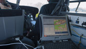
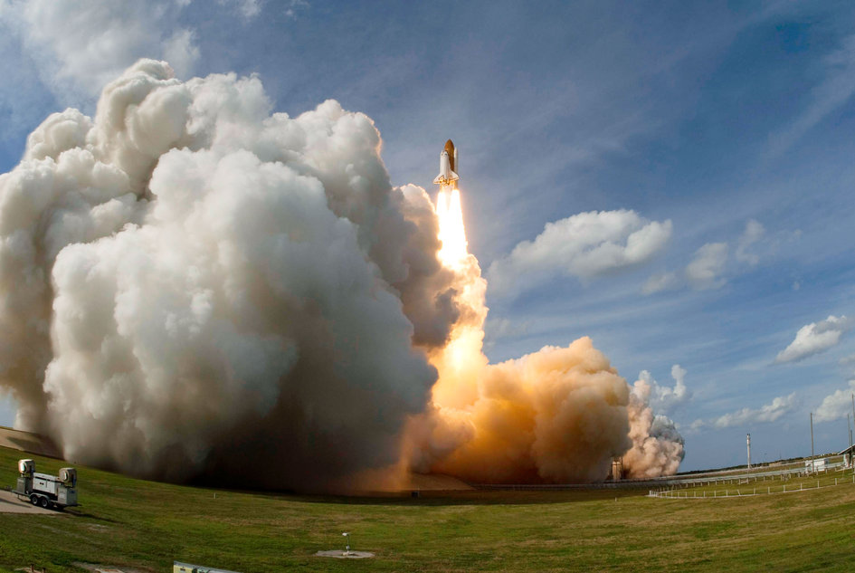
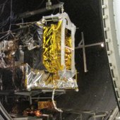
domingo, 17 de febrero de 2013

ESA - EGNOS plus Galileo will equal even safer skies


Test helicopter
 A helicopter flew over the Galileo Test and Development Environment – GATE – in Berchtesgaden, Germany, to gather data on how Europe’s two satellite navigation systems – EGNOS and Galileo – will work together in future. The helicopter flew a variety of manoeuvres, from fast loops to mid-air hovering, to see how satnav signals were received in practice. Results from the 24-26 September testing have proved positive for a future dual-constellation evolution of the EGNOS system, incorporating both GPS and Galileo signals.
13 February 2013 Europe’s two satellite navigation systems could combine in future for heightened performance, an airborne test has confirmed. A helicopter flight took place above an Alpine valley, the one place on Earth where Galileo services are already routinely available.
Results of last autumn’s flight test show that adding Galileo signals to the European Geostationary Navigation Overlay Service – EGNOS – that currently augments the accuracy and reliability of US GPS signals over Europe should boost its accuracy significantly. EGNOS renders satnav usable for safety-critical applications such as aircraft guidance as well as more general precision uses.
Operational horizontal and vertical distance 'protection levels' for safety were cut by approximately half by combining use of GPS and Galileo within EGNOS.
Test receiver
  (971.85 kB)

In addition, new integrity algorithms installed within the user receiver turned out to reliably detect and exclude reflected or otherwise faulty signals.
The first test of real Galileo navigation fixes is scheduled for later this year from the four satellites already in orbit, with more satellites set to join them by the end of the year.
As the constellation takes shape, satnav researchers and industrial developers can already try out Galileo services with prototype receivers at the giant outdoor laboratory that is the German Galileo Test and Development Environment, or GATE.
'Galileo valley'
  (2.28 MB
the town of Berchtesgaden in the Bavarian Alps has transmitters atop eight neighbouring mountain peaks to blanket 65 sq km of territory with satnav signals.
The result is the Galileo Test and Development Environment – GATE – a giant outdoor laboratory where prototype Galileo receivers can be used freely without any modifications.


GATE, in and around the town of Berchtesgaden in the Bavarian Alps, is Europe’s go-to place for Galileo testing: transmitters atop eight neighbouring mountains cover 65 sq km of territory with simulated Galileo signals.
ESA’s Global Navigation Satellite System Evolution programme carried out helicopter-based testing here on 24–26 September 2012. The results will help to guide the development of next-generation satnav systems.
The helicopter flew a variety of manoeuvres, from fast loops to mid-air hovering, to see how satnav signals were received in practice. 
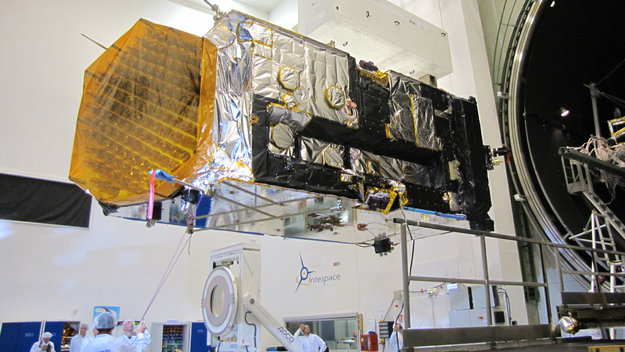
Testing EGNOS with Galileo
  (1.66 MB)

The test relied on ESA’s SPEED platform – Support Platform for EGNOS Evolutions & Demonstrations, co-funded by French space agency CNES and operated by Thales Alenia Space France – which enabled the receiver to receive simultaneous realtime augmentation for both GPS and Galileo.
Europe’s next-generation EGNOS, planned for around 2020, is envisaged to operate in the same way, with augmentation of both constellations and dual-frequencies at the same time making the system much more robust.
ESA
Guillermo Gonzalo Sánchez Achutegui
ayabaca@gmail.com
ayabaca@hotmail.com
ayabaca@yahoo.com

ESA - At the mouth of the red valley


High-Resolution Stereo Camera nadir and colour channel data taken during revolution 11497 on 13 January 2013 by ESA’s Mars Express have been combined to form a natural-colour view of the region southeast of Amenthes Planum and north of Hesperia Planum. The region imaged, which lies to the west of Tinto Vallis and Palos crater, is centred at around 3°S and 109°E, and has a ground resolution of about 22 m per pixel.
The image features craters, lava channels and a valley from which water may have once flowed. Dark wind-blown sediments fill the valleys and the floors of the craters.

ESA’s Mars Express took a high-resolution stereo image on 13 January of the southeast corner of the Amenthes Planum region on Mars, near to Palos crater and the mouth of a well-known sinuous valley, Tinto Vallis.
At the bottom-centre of the full-colour image above, and up close in the first perspective image, is a nearby shorter and wider valley, which is fed by a number of tributaries before it joins the mouth of Tinto Vallis as both empty into Palos crater, just off the bottom of the image.
The 190 km-long Tinto Vallis is seen in the context image and is named after the famous Rio Tinto river in the Andalucía region of Spain. It is believed to have formed around 3.7 billion years ago, during the early history of Mars.
Valley feeding Palos Crater
 

The network of shorter valleys shown in the first perspective image is thought to have formed through volcanic activity melting subsurface ice and liberating water to the martian surface via seeps and springs.
If underground water emerges to the surface from the side of a slope – a process that planetary geologists call ‘groundwater sapping’ – it weakens the ground above it, causing it to collapse. Over time, this process may lead to the formation of steep-sided U-shaped valleys.
Groundwater sapping is believed to be responsible for erosion seen in many of the valley networks on the Red Planet.
Amenthes Planum in context
Another eye-catching feature is the relatively deep 35 km-wide crater seen in the left-hand portion of the colour, topographic and 3D images. Spectacular landslides along the crater’s walls can be seen and are particularly evident along the broken southern (left) rim.
This crater sits on top of at least three older craters, the largest of which is 100 km wide and dominates the whole top left half of the 2D and 3D anaglyph images. The western rim of this crater continues beyond the image frame, and can be more easily distinguished in the context image.
Amenthes Planum topography
 

The floor of this 100 km-wide crater is chaotic, with flat-topped geological features called mesas, and their smaller siblings, buttes, littering the floor. These are probably the result of the removal of subsurface water ice leading to the collapse of weaker material around them, leaving these more resistant high-sided features behind.
On Earth, the desert regions in Utah are home to many examples of these types of formation.
Trough feeding Amenthes Planum


Toward the north (right) side of the 2D images, several smaller craters display very smooth and flat floors, from infilling by sediments.
The darker regions to the far north and south shown most clearly in the first colour image are covered in wind-transported basaltic sands.
The smooth low-lying region to the far right and shown in the second perspective image is a small trough that feeds into the broader lava field of Amenthes Planum. The trough has likely been modified by the outflow of material from the ancient lake that may have once existed in Palos crater, the rim of which can only just be seen at the bottom of the colour, topographic and 3D images.
This smooth, channel-like feature brushes against the rim of a 30 km-wide crater, and both have been covered with dark wind-blown materials.
Amenthes Planum in 3D


With these recent images, Mars Express continues to show the similarities between regions on Mars with those on our home planet.
ESA
Guillermo Gonzalo Sánchez Achutegui
ayabaca@gmail.com
ayabaca@hotmail.com
ayabaca@yahoo.com

domingo, 10 de febrero de 2013

ESA - Columbus anniversary


Columbus launched onboard Space Shuttle Atlantis

Columbus launched onboard Space Shuttle Atlantis Space Shuttle Atlantis and its seven-member STS-122 crew head toward the International Space Station. Liftoff from Kennedy Space Center's launch pad 39A occurred at 12:45 (EST). The launch was the third attempt for Atlantis since December 2007 to carry ESA's Columbus laboratory to the Station. During the 11-day mission, the crew's primary objective was to attach the laboratory to the Harmony module, adding to the station's size and capabilities. Onboard are astronauts Steve Frick, commander; Alan Poindexter, pilot; Leland Melvin, Rex Walheim, ESA's Hans Schlegel, Stanley Love and ESA's Leopold Eyharts, all mission specialists. Léopold joined Expedition 16 to serve as a flight engineer aboard the International Space Station.
Credits: NASA

Columbus installation first spacewalk
  (937.74 kB
Columbus installation first spacewalk The European Columbus laboratory was installed during the first spacewalk of the STS-122 mission. NASA astronauts Stanley Love and Rex Walheim spent nearly 8 hours outside the International Space Station. Their tasks included preparation of the Columbus laboratory for transfer from Space Shuttle Atlantis' payload bay to the starboard side of the Station's Harmony module.
Credits: NASA
NASA Astronaut Rex Walheim hanging on to Columbus
(1.53 MB)
NASA Astronaut Rex Walheim hanging on to Columbus NASA astronaut Rex Walheim, mission specialist, holds onto a handrail on the Columbus laboratory on the International Space Station. His helmet visor mirrors the forward section of the Space Shuttle Atlantis that is docked to the Station. NASA astronaut Stanley Love (out of frame), mission specialist, shared this final period of STS-122 spacewalk with Rex.
Credits: NASA
On 7 February 2008 Space Shuttle Atlantis was launched to the International Space Station carrying ESA's Columbus laboratory.
Over 6 m long and more than 10 tonnes, its shell was built in Italy and completed in Germany. Columbus was shipped to the US to be launched from the Kennedy Space Center. ESA astronauts Léopold Eyharts and Hans Schlegel joined the Shuttle crew to install the module on the orbital complex.
Since then, more than a hundred ESA-led experiments have been conducted in many areas such as biology, fluid physics, material sciences, radiation physics and the human body.
More
Five years of supporting science from ESA's Columbus Control Centre
Related Articles:
ESA
Guillermo Gonzalo Sánchez Achutegui
ayabaca@gmail.com
ayabaca@hotmail.com
ayabaca@yahoo.com

ESA - Week in Images


This image combines Hubble observations of M 106 with additional information captured by amateur astronomers Robert Gendler and Jay GaBany. Gendler combined Hubble data with his own observations to produce this stunning colour image. M 106 is a relatively nearby spiral galaxy, a little over 20 million light-years away.
Credits: NASA, ESA, the Hubble Heritage Team (STScI/AURA), and R. Gendler (for the Hubble Heritage Team). Acknowledgment: J. GaBany, A van der Hoeven
Mapping Mars
 
 
Mapping Mars The latest Mars image mosaic as seen through the lens of the High Resolution Stereo Camera on ESA’s Mars Express.
The mosaic comprises 2702 individual swaths of the martian surface, up to and including the spacecraft’s 10 821st orbit of the planet, which it completed on 30 June 2012.
In total, 87.8% of the surface has been mapped at any resolution, with 61.5% mapped at a resolution of 20 m per pixel or better.
Each white marker around the border of the image represents 10º of latitude or longitude.
This image was released as a Space Science Image of the Week feature on 4 February 2013.
Credits: ESA/DLR/FU Berlin (G. Neukum); images processed by F. Jansen (ESA).

Space penguin

Space penguin This Adélie Penguin is not from outer space but its nearest equivalent on Earth: Antarctica. The penguin was photographed at Terra Nova Bay, Antarctica by ESA-sponsored medical research doctor Vangelis Kaimakamis on one of his stopovers on the long voyage to Concordia research station in the heart of the white continent.
His voyage took him from Greece to Germany, Singapore, Australia and New Zealand before arriving at McMurdo base in Antarctica. From there he transferred to the Italian Zucchelli Station at Terra Nova Bay, where weather grounded him for a week.
The Adélie Penguin may have been one of the last animals Vangelis sees during his 10-month stay at Concordia because no living being can survive the harsh conditions there. With temperatures as low as –80°C, no outside help can be flown in during the winter and even the Sun does not rise above the horizon for four months.
The closest base to Concordia is the Russian Vostok outpost, some 600 km away. In comparison, the International Space Station is closer to civilisation – astronauts can escape in an emergency and land in under four hours.
Vangelis will run experiments on how people adapt to the stress of living in close isolation. The research this year will be as diverse as studying how the crew’s body posture changes and which materials are more resistant to bacterial growth.
This is one of the many ways ESA is studying human physiology and psychology in preparation for future long missions beyond Earth.
Credits: n/a

Lake Powell, United States
 
 
Lake Powell, United States This Landsat image from 19 July 2011 shows Lake Powell, a reservoir on the Colorado River in the southwestern United States. Straddling the border of the states Utah (to the north) and Arizona (to the south), it is the second largest artificial lake in the country. The area to the north of Lake Powell is known as the Grand Staircase-Escalante National Monument, and covers over 760 000 hectares. Appearing green in this false-colour image, the Kaiparowits Plateau makes up a significant portion of the Monument, with the Fiftymile mountain (dark green) separating it from the Escalante Canyons. Another feature of the Monument is the Grand Staircase – a sequence of sedimentary rock layers – part of which is visible in the lower-left corner.
This image is featured on the Earth from Space video programme.
Credits: USGS/ESA

ESO 121-6 seen by Hubble

ESO 121-6 seen by Hubble This thin, glittering streak of stars is the spiral galaxy ESO 121-6, which lies in the southern constellation of Pictor (The Painter's Easel). Viewed almost exactly side-on, the intricate structure of the swirling arms is hidden, but the full length of the galaxy can be seen — including the intense glow from the central bulge, a dense region of tightly packed young stars sitting at the centre of the spiral arms.
Tendrils of dark dust can be seen across the frame, partially obscuring the bright centre of the galaxy and continuing out towards the smattering of stars at its edges, where the dust lanes and shapes melt into the inky background. Numerous nearby stars and galaxies are visible as small smudges in the surrounding sky, and the brightest stars are dazzlingly prominent towards the bottom left of the image.
ESO 121-6 is a galaxy with patchy, loosely wound arms and a relatively faint central bulge. It actually belongs to a group of galaxies, a clump of no more than 50 similar structures all loosely bound to one another by gravity. The Milky Way is also a member of a galactic group, known as the Local Group.
Credits: ESA/Hubble & NASA
ESA
Guillermo Gonzalo Sánchez Achutegui
ayabaca@gmail.com
ayabaca@hotmail.com
ayabaca@yahoo.com 

ESA - Alphasat experiences heaven on Earth


8 February 2013 Tucked away in a vacuum chamber for several months, Europe’s largest telecom satellite has faced the harsh conditions it will deal with once it is launched into space this summer.
Testing at Intespace in Toulouse, France, simulated conditions close to those Alphasat will experience in flight, including the intense cold of its transfer orbits in the early stages of the mission.
Not only was Alphasat’s ability to control its temperature tested, but other features were also put through their paces to ensure everything can run under the extreme cold and hot conditions.
Alphasat inside the Intespace Simmer vacuum chamber.
Inside the Intespace Simmer vacuum chamber
“If you were going to test a new car for extreme conditions, you would probably want to do the same thing: not only check the heating and air conditioning, but also make sure that the engine, brakes, ignition and radio work in low temperatures as well as high,” explained Philippe Sivac, ESA’s Alphasat acting project manager.
To monitor the satellite inside the large chamber, nearly 600 temperature sensors were attached in key locations. A satellite the size of Alphasat can also carry up to 400 flight thermal sensors.
Alphasat’s customer team take a final look before the chamber door is closed.
Alphasat's customer service team
Readouts are displayed in real time, together with the satellite’s internal data to help build an overall picture for the team monitoring Alphasat around the clock.
Running Alphasat under very stable thermal situations showed that the thermal-mathematical model is well suited to predict the temperatures in orbit.
“Finally, the performance and functional tests show that all the electronics and software perform as expected even at extreme temperatures.”
However, the model will further be checked and refined where needed.  “This will require a lot of data processing to adjust the thermal model and make it fit to the measurements gathered during the test,” notes Philippe.
Engineers took this opportunity to test new methods and tools that will speed up the processing of such large amounts of information.
The vacuum chamber door closes
All satellites endure a similar series of demanding tests before they are considered to be qualified for launch. Usually it takes about a month, but Alphasat is not quite like other telecom satellites.
Five thermal engineers from ESA worked around-the-clock throughout the extended tests, even working through the Christmas break.
“The complexity of the payload, the number of redundancies and configurations to test and customer specific requirements required testing to exceed two months,” says Philippe.
And that’s not all. While the 10 m-long, 8 m-diameter chamber was large enough for Alphasat, the handling equipment had to be modified to accommodate the massive satellite.
The Simmer chamber door is closed and sealed on Alphasat
Chamber door is closed and sealed
Alphasat is a high-power telecom satellite built by Astrium, through a public–private partnership between ESA and UK operator Inmarsat.
It is based on the mighty Alphabus, the new European telecom platform developed by Astrium and Thales Alenia Space under joint contract from ESA and the French space agency, CNES.
Alphabus is Europe’s response to increased market pressure for larger telecom payloads for direct-to-home TV broadcasting, digital audio broadcasting, broadband access and mobile services.
Launch is expected this summer aboard an Ariane 5 from Europe’s Spaceport in French Guiana.


Alphasat experiences heaven on Earth

08 Feb 2013
Tucked away in a vacuum chamber for several months, Europe’s largest telecom satellite has faced the harsh conditions it will deal with once it is launched into space this summer.
Testing at Intespace in Toulouse, France, simulated conditions close to those Alphasat will experience in flight, including the intense cold of its transfer orbits in the early stages of the mission.
Not only was Alphasat’s ability to control its temperature tested, but other features were also put through their paces to ensure everything can run under the extreme cold and hot conditions.
“If you were going to test a new car for extreme conditions, you would probably want to do the same thing: not only check the heating and air conditioning, but also make sure that the engine, brakes, ignition and radio work in low temperatures as well as high,” explained Philippe Sivac, ESA’s Alphasat acting project manager.
To monitor the satellite inside the large chamber, nearly 600 temperature sensors were attached in key locations. A satellite the size of Alphasat can also carry up to 400 flight thermal sensors.
Readouts are displayed in real time, together with the satellite’s internal data to help build an overall picture for the team monitoring Alphasat around the clock.
Running Alphasat under very stable thermal situations showed that the thermal-mathematical model is well suited to predict the temperatures in orbit.
However, the model will further be checked and refined where needed. “This will require a lot of data processing to adjust the thermal model and make it fit to the measurements gathered during the test,” notes Philippe.
Engineers took this opportunity to test new methods and tools that will speed up the processing of such large amounts of information.
“Finally, the performance and functional tests show that all the electronics and software perform as expected even at extreme temperatures.”
All satellites endure a similar series of demanding tests before they are considered to be qualified for launch. Usually it takes about a month, but Alphasat is not quite like other telecom satellites.
Five thermal engineers from ESA worked around-the-clock throughout the extended tests, even working through the Christmas break.
“The complexity of the payload, the number of redundancies and configurations to test and customer specific requirements required testing to exceed two months,” says Philippe.
And that’s not all. While the 10 m-long, 8 m-diameter chamber was large enough for Alphasat, the handling equipment had to be modified to accommodate the massive satellite.
Alphasat is a high-power telecom satellite built by Astrium, through a public–private partnership between ESA and UK operator Inmarsat.
It is based on the mighty Alphabus, the new European telecom platform developed by Astrium and Thales Alenia Space under joint contract from ESA and the French space agency, CNES.
Alphabus is Europe’s response to increased market pressure for larger telecom payloads for direct-to-home TV broadcasting, digital audio broadcasting, broadband access and mobile services.
Launch is expected this summer aboard an Ariane 5 from Europe’s Spaceport in French Guiana.
For more information see the links in the column to the right.
http://telecom.esa.int/telecom/media/img/hiresimage/Alphasat-entry-in-TVAC-hres.jpg
Download/View jpg (160 kb)  


ESA
Guillermo Gonzalo Sánchez Achutegui
ayabaca@gmail.com
ayabaca@hotmail.com
ayabaca@yahoo.com 

ESA - Extraños en la noche: una roca espacial hace un “vuelo de reconocimiento” sobre la Tierra


Artist's impression of NEO asteroids passing Earth ESA SSA
Artist's impression of asteroids passing Earth


7 febrero 2013
El próximo 15 de febrero, un asteroide del cual sabemos muy poco, echará un vistazo sobre la Tierra a una distancia de la superficie de tan solo 28.000 km. Este pedazo de roca espacial, de 50 metros de diámetro, fue descubierto desde España en el año 2012 por astrónomos aficionados, con el patrocinio del programa Space Situational Awareness (Conocimiento del Medio Espacial) de la ESA.
Tenemos pocos datos de este viejo asteroide, 2012 DA14; no hay disponibles medidas directas de su tamaño. Por su brillo, los científicos estiman que tiene un diámetro de entre 50 y 80 metros. Se desconoce su composición, y se cree que su masa es del orden de 130.000 toneladas. 
Lo que sí se sabe es que no impactará contra la Tierra a corto plazo. 
"Su órbita puede calcularse con bastante precisión utilizando NEODyS, la base de datos europea de asteroides; estos cálculos muestran que podemos excluir la posibilidad de una colisión con la Tierra con bastante seguridad, al menos durante este siglo" afirma Detlef Koschny, responsable del estudio de objetos cercanos a la Tierra (NEOs por sus siglas en inglés) en la oficina del programa SSA, Space Situational Awareness (Conocimiento del Medio Espacial) de la ESA. 

Asteroid 2012 DA14
El 15 de febrero de 2013, el asteroide tendrá su máximo acercamiento a nuestro planeta durante este siglo al pasar justo a unos 28.000 kilómetros, a una velocidad de 7,8 km por segundo. 
"Eso significa que está dentro de la órbita geoestacionaria, en la que se encuentran numerosos satélites de comunicaciones", dice Koschny. "Sin embargo, no hay peligro para esos satélites, dado que el asteroide llega “desde abajo” y no cruza el cinturón geoestacionario". 
El asteroide tendrá su máximo acercamiento a eso de las 20:40 CET (19:40 UTC) el próximo viernes por la tarde. Pese a su pequeñez frente al vasto Sistema Solar, debería ser visible en Europa para cualquiera que utilice un buen par de prismáticos y sepa dónde mirar (ver detalles más abajo).
El asteroide fue descubierto el 22 de febrero de 2012 por el sondeo “La Sagra Sky Survey (LSSS)”, que cuenta con el patrocinio del programa SSA de la ESA. El observatorio LSSS se encuentra en el sudeste de España, cerca de Granada, a una altitud de 1.700 metros, en uno de los lugares más oscuros  y con menos contaminación lumínica de la Europa continental. 
El pequeño tamaño y la órbita, previamente desconocida, de 2012 DA14, hicieron que su localización solo fuera posible tras haber pasado de largo cerca de la Tierra, a unas siete veces la distancia entre nuestro planeta y la Luna. 
"Si este objeto fuera de hierro y fuera a estrellarse contra nuestro planeta, podría generar un cráter comparable, por ejemplo, al cráter de impacto de 1,5 kilómetros cercano a Flagstaff, Arizona”, afirma Koschny. "Aunque esto no ocurrirá".
ESA
Artículos Relacionados:

Guillermo Gonzalo Sánchez Achutegui
ayabaca@gmail.com
ayabaca@hotmail.com
ayabaca@yahoo.com