8 February 2013
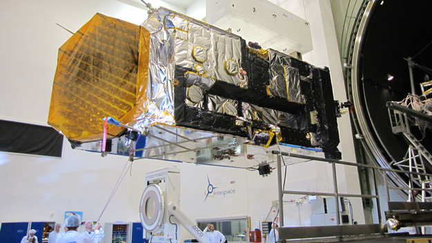
Tucked away in a vacuum chamber for several months, Europe’s largest
telecom satellite has faced the harsh conditions it will deal with once
it is launched into space this summer.
Testing at Intespace in Toulouse, France, simulated conditions close to
those Alphasat will experience in flight, including the intense cold of
its transfer orbits in the early stages of the mission.
Not only was Alphasat’s ability to control its temperature tested, but
other features were also put through their paces to ensure everything
can run under the extreme cold and hot conditions.
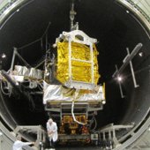
Inside the Intespace Simmer vacuum chamber
“If you were going to test a new car for extreme conditions, you would
probably want to do the same thing: not only check the heating and air
conditioning, but also make sure that the engine, brakes, ignition and
radio work in low temperatures as well as high,” explained Philippe
Sivac, ESA’s Alphasat acting project manager.
To monitor the satellite inside the large chamber, nearly 600
temperature sensors were attached in key locations. A satellite the size
of Alphasat can also carry up to 400 flight thermal sensors.
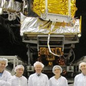
Alphasat's customer service team
Readouts are displayed in real time, together with the satellite’s
internal data to help build an overall picture for the team monitoring
Alphasat around the clock.
Running Alphasat under very stable thermal situations showed that the
thermal-mathematical model is well suited to predict the temperatures in
orbit.
“Finally, the performance and functional tests show that all the
electronics and software perform as expected even at extreme
temperatures.”
However, the model will further be checked and refined where needed.
“This will require a lot of data processing to adjust the thermal model
and make it fit to the measurements gathered during the test,” notes
Philippe.
Engineers took this opportunity to test new methods and tools that will
speed up the processing of such large amounts of information.
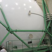
The vacuum chamber door closes
All satellites endure a similar series of demanding tests before they
are considered to be qualified for launch. Usually it takes about a
month, but Alphasat is not quite like other telecom satellites.
Five thermal engineers from ESA worked around-the-clock throughout the extended tests, even working through the Christmas break.
“The complexity of the payload, the number of redundancies and
configurations to test and customer specific requirements required
testing to exceed two months,” says Philippe.
And that’s not all. While the 10 m-long, 8 m-diameter chamber was large
enough for Alphasat, the handling equipment had to be modified to
accommodate the massive satellite.
Chamber door is closed and sealed
Alphasat is a high-power telecom satellite built by Astrium, through a
public–private partnership between ESA and UK operator Inmarsat.
It is based on the mighty Alphabus, the new European telecom platform
developed by Astrium and Thales Alenia Space under joint contract from
ESA and the French space agency, CNES.
Alphabus is Europe’s response to increased market pressure for larger
telecom payloads for direct-to-home TV broadcasting, digital audio
broadcasting, broadband access and mobile services.
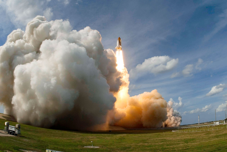
Launch is expected this summer aboard an Ariane 5 from Europe’s Spaceport in French Guiana.

Alphasat experiences heaven on Earth
08 Feb 2013
Tucked away in a vacuum chamber for several months, Europe’s
largest telecom satellite has faced the harsh conditions it will deal
with once it is launched into space this summer.
Testing at Intespace in Toulouse, France, simulated conditions
close to those Alphasat will experience in flight, including the intense
cold of its transfer orbits in the early stages of the mission.
Not only was Alphasat’s ability to control its temperature tested,
but other features were also put through their paces to ensure
everything can run under the extreme cold and hot conditions.
“If you were going to test a new car for extreme conditions, you
would probably want to do the same thing: not only check the heating and
air conditioning, but also make sure that the engine, brakes, ignition
and radio work in low temperatures as well as high,” explained Philippe
Sivac, ESA’s Alphasat acting project manager.
To monitor the satellite inside the large chamber, nearly 600
temperature sensors were attached in key locations. A satellite the size
of Alphasat can also carry up to 400 flight thermal sensors.
Readouts are displayed in real time, together with the satellite’s
internal data to help build an overall picture for the team monitoring
Alphasat around the clock.
Running Alphasat under very stable thermal situations showed that the
thermal-mathematical model is well suited to predict the temperatures
in orbit.
However, the model will further be checked and refined where needed.
“This will require a lot of data processing to adjust the thermal model
and make it fit to the measurements gathered during the test,” notes
Philippe.
Engineers took this opportunity to test new methods and tools that
will speed up the processing of such large amounts of information.
“Finally, the performance and functional tests show that all the
electronics and software perform as expected even at extreme
temperatures.”
All satellites endure a similar series of demanding tests before they
are considered to be qualified for launch. Usually it takes about a
month, but Alphasat is not quite like other telecom satellites.
Five thermal engineers from ESA worked around-the-clock throughout the extended tests, even working through the Christmas break.
“The complexity of the payload, the number of redundancies and
configurations to test and customer specific requirements required
testing to exceed two months,” says Philippe.
And that’s not all. While the 10 m-long, 8 m-diameter chamber was
large enough for Alphasat, the handling equipment had to be modified to
accommodate the massive satellite.
Alphasat is a high-power telecom satellite built by Astrium, through a
public–private partnership between ESA and UK operator Inmarsat.
It is based on the mighty Alphabus, the new European telecom platform
developed by Astrium and Thales Alenia Space under joint contract from
ESA and the French space agency, CNES.
Alphabus is Europe’s response to increased market pressure for larger
telecom payloads for direct-to-home TV broadcasting, digital audio
broadcasting, broadband access and mobile services.
Launch is expected this summer aboard an Ariane 5 from Europe’s Spaceport in French Guiana.
For more information see the links in the column to the right.
ESA
Guillermo Gonzalo Sánchez Achutegui
ayabaca@gmail.com
ayabaca@hotmail.com
ayabaca@yahoo.com


 (1.14 MB)

 (1.36 MB)

 (1.80 MB)
 (971.85 kB
 (2.28 MB
 (1.66 MB
 (454.15 kB)
 (937.74 kB
 (1.53 MB

 (1.18 MB)


 (3.70 MB)
 (2.10 MB)
 (6.31 MB)


 QuickTime