Mostrando entradas con la etiqueta National Science Foundation. Mostrar todas las entradas

jueves, 1 de noviembre de 2012

National Science Foundation - Science on the Graveyard Shift


http://www.nsf.gov/news/mmg/media/images/DSC001193.JPG
Graveyards are excellent research sites; their soil lies undisturbed.
Credit: Kyungsoo Yoo
Download the high-resolution JPG version of the image. (97 KB)http://www.nsf.gov/news/mmg/media/images/DSC001103.JPG
Anthony Aufdenkampe and Rolf Aalto, to right of tree, inspect an ancient oak in a cemetery in London Grove, Pa.
Credit: Kyungsoo Yoo
Download the high-resolution JPG version of the image. (101 KB)http://www.nsf.gov/news/mmg/media/images/IMG_3763%203%20oak%20plate3.jpg
This "Penn Oak," or white oak, was standing when William Penn arrived in Pennsylvania in 1682.
Credit: Beth Wenell
Download the high-resolution JPG version of the image. (115 KB)http://www.nsf.gov/news/mmg/media/images/DSC001143.JPG
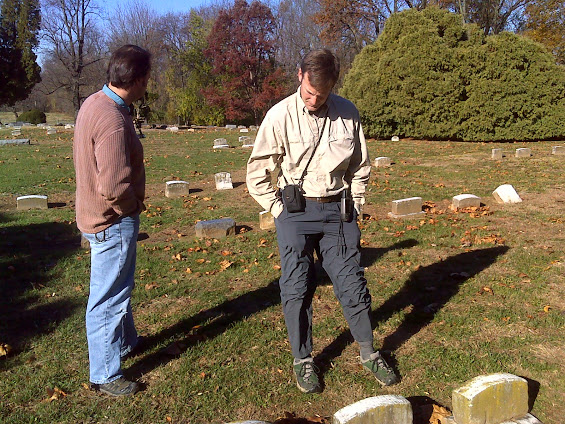
Anthony Aufdenkampe (right), and Rolf Aalto, shown at London Grove Friends Meeting cemetery.
Credit: Kyungsoo Yoo
Download the high-resolution JPG version of the image. (154 KB)http://www.nsf.gov/news/mmg/media/images/christinabasin_basemap3.png
Map of the Christina River Basin, site of one of six NSF Critical Zone Observatories (CZOs).
Credit: Wikimedia Commons
Download the high-resolution PNG version of the image. (180 KB)http://www.nsf.gov/news/mmg/media/images/800px-Christina_River3.jpg
The Christina River flows through three states: Pennsylvania, Maryland and Delaware.
Credit: Wikimedia Commons
Download the high-resolution JPG version of the image. (184 KB)
The following is part three in a series on the National Science Foundation's Critical Zone Observatories (CZOs). Part one describes the work of the Susquehanna Shale Hills CZO. Part two focuses on the Southern Sierra CZO.
Into the graveyard
By dark of night in an old graveyard, things rustle. At least if that cemetery is at London Grove Friends Meeting in Kennett Square, Pa.
Look between the oldest markers, or under a gnarled oak tree that's been guarding the graveyard since the time of William Penn in 1682. You'll find not a ghost, but a scientist, probing the dirt for the secrets it might reveal.
"These soils have been undisturbed for centuries, if at all, and they hold the key to understanding how humans have altered the landscape," says geoscientist Anthony Aufdenkampe of the National Science Foundation's (NSF) Christina River Basin Critical Zone Observatory (CZO) on the border of Delaware and Pennsylvania.
To discover answers, Aufdenkampe, who is also affiliated with Pennsylvania's Stroud Water Research Center, is in graveyards taking samples at noon and at midnight. "We do a lot of storm-chasing to follow erosion," says Aufdenkampe, "so we're often out at the 'witching hour.'"
The Christina River Basin CZO is one of six NSF CZOs in watersheds across the nation.
In addition to the Christina River Basin site, CZOs are located in the Southern Sierra Nevada, Boulder Creek in the Colorado Rockies, Susquehanna Shale Hills in Pennsylvania, Luquillo riparian zone in Puerto Rico, and the Jemez River and Santa Catalina Mountains in New Mexico and Arizona.
They're providing us with a new understanding of the critical zone--the region between the top of the forest canopy and the base of unweathered rock: our living environment--and its response to climate and land use changes.
Marked by rotting soil
It all starts with bedrock and with rotting soil.
To scientists, this putrid rock, as the Greeks called it, is known as saprolite. It's the first stage of the continuous transformation of rock to fertile soils, says Aufdenkampe, and needs thousands to millions of years of mixing by water, plants, microbes, worms and other organisms.
But its journey doesn't end there.
For centuries, researchers thought that these building blocks of life stayed close to home--that the molecules in a falling leaf didn't travel far before meeting their ultimate fates. They returned to the atmosphere as greenhouse gas, or became incorporated into the soil.
Now scientists at the Christina River Basin CZO believe otherwise.
They're testing the idea that erosion and mixing of soil minerals with carbon in fresh plant remains--and subsequent burial downslope or downstream--is the key to what happens to the carbon, and to the greenhouse gases it forms.
Aufdenkampe and colleagues published results of a study comparing carbon transport in watersheds such as the Christina River Basin and others around the world in the February 2011, issue of the journal Frontiers in Ecology and the Environment.
"Society has long recognized the importance of water, soil, vegetation and land forms to human welfare, but only recently have we begun to holistically probe the workings of these coupled systems in projects like the CZOs," says Wendy Harrison, director of NSF's Division of Earth Sciences, which funds the CZO network.
"This new way of doing science will allow us to predict how an entire watershed will respond to land use and climate change."
Scientists once believed that they could understand whether a forest or a field was storing greenhouse gases by studying small research plots alone.
"Now we know that we need to look carefully at all the forms of carbon that leave a plot and flow downhill and downstream," says Aufdenkampe. "We need to follow the carbon and the soil from saprolite to the sea."
Twists and turns of the Christina River
Sippunk, Tasswaijres, Minquess Kill. The Christina River has been known by these names and many others.
It's a tributary of the Delaware River; its 35 miles flow through southeastern Pennsylvania, northeastern Maryland, and into Delaware. From Franklin Township in Pennsylvania to Wilmington, Delaware, the Christina River and its tributaries drain an area of 565 square miles.
Its streams supply 100 million gallons of water each day for more than half a million people in three states.
The first European settlements in Delaware sprang up near the confluence of the Christina and Delaware rivers. Trees lining the banks of the rivers, and across the land, were felled. In their place came farms and factories.
How has the region's human history affected rivers and streams that now course through forests and farms, suburbs and cities? And how has this centuries-old legacy changed the carbon cycle in the Christina River Basin watershed?
To find out, Aufdenkampe picks up a shovel. As he digs through fallen leaves and several feet of dirt on a streambank flanked by gravestones, stripes of soil begin to emerge.
In their center is something dark and moist. Perfectly preserved, it's a part of the bank buried hundreds of years ago by erosion caused by colonial forefathers.
Scientists at the Christina River CZO hope to discover how this sediment--and that above and below it--was deposited, and where waterways may carry it next, if anywhere.
"How are humans affecting the carbon cycle in a watershed like the Christina River Basin?" asks Aufdenkampe. "How far afield does what happens here go? Does it reach the Delaware, the Atlantic or beyond?"
Research at the CZO takes a "whole watershed" approach to discovering where carbon and other elements end up.
"They usually have one of three fates," Aufdenkampe says, "a return to the skies as a greenhouse gas, incorporation into the tissues of a living organism, or burial in soils and sediments."
From dust to dust
Where do scientists look for clues to those ultimate fates? They dig into soils and scour waterways, with a stop along the way near a local cemetery or two.
"Soils under ancient trees and in old cemeteries provide a geochemical reference that we can use to estimate human-caused erosion elsewhere on the landscape," says Aufdenkampe.
People inevitably leave their mark on the land, he says. But will the carbon buried by 400 years of human activities give up the ghost and move on, or will it rest in peace?
"In the future," Aufdenkampe asks, "will what's in the soil return to haunt us all?"
--  Cheryl Dybas, NSF (703) 292-7734 cdybas@nsf.gov
Related Websites
NSF Critical Zone Observatories: Where Rock Meets Life: http://www.criticalzone.org/
NSF Christina River Basin Critical Zone Observatory: http://www.udel.edu/czo/
NSF Discovery Article: A Tree Stands in the Sierra Nevada: http://www.nsf.gov/discoveries/disc_summ.jsp?cntn_id=125091&org=NSF
NSF Discovery Article: Can Marcellus Shale Gas Development and Healthy Waterways Sustainably Coexist?: http://www.nsf.gov/discoveries/disc_summ.jsp?cntn_id=122543&org=NSF
NSF News Release: NSF Awards Grants for Three Critical Zone Observatories: http://www.nsf.gov/news/news_summ.jsp?cntn_id=110586
NSF Science, Engineering and Education for Sustainability Investment: http://www.nsf.gov/sees/
The National Science Foundation (NSF)
Guillermo GOnzalo Sánchez Achutegui
ayabaca@gmail.com
ayabaca@hotmail.com
ayabaca@yahoo.com

domingo, 29 de abril de 2012

Frog: Blood Samples Show Deadly Frog Fungus at Work in the Wild

 Hi My Friends:: AL VUELO DE UN QUINDE EL BLOG., The fungal infection that killed a record number of amphibians worldwide leads to deadly dehydration in frogs in the wild, according to results of a new study.
Mountain yellow-legged frog: Disease has left it high and dry in its aquatic habitat.
Credit and Larger Version

The mountain yellow-legged frog is an amphibian species affected by the chytrid fungus.
Credit and Larger Version
Research site: the Sixty Lakes Basin of Kings Canyon National Park in the Sierra Nevada.
Credit and Larger Version
Scientist Vance Vredenburg is shown with one of the frogs he and his colleagues study.
Credit and Larger Version
An adult female mountain yellow-legged frog with a radio belt for tracking.
Credit and Larger Version

Press Release 12-075
Blood Samples Show Deadly Frog Fungus at Work in the Wild

Pathogen leads to dehydration, other ill effects
The fungal infection that killed a record number of amphibians worldwide leads to deadly dehydration in frogs in the wild, according to results of a new study.
High levels of an aquatic, chytrid fungus called Batrachochytrium dendrobatidis (Bd) disrupt fluid and electrolyte balance in wild frogs, the scientists say, severely depleting the frogs' sodium and potassium levels and causing cardiac arrest and death.
Their findings confirm what researchers have seen in carefully controlled lab experiments with the fungus, but San Francisco State University biologist Vance Vredenburg said the data from wild frogs provide a much better idea of how the disease progresses.
"The mode of death discovered in the lab seems to be what's actually happening in the field," he said, "and it's that understanding that is key to doing something about it in the future."
Results of the study are published today in the journal PLoS ONE.
"Wildlife diseases can be just as devastating to our health and economy as agricultural and human diseases," said Sam Scheiner, NSF program officer for the joint National Science Foundation-National Institutes of Health Ecology and Evolution of Infectious Diseases program, which funded the research.
At NSF, the Directorates for Biological Sciences and Geosciences support the program.
"Bd has been decimating frog and salamander species worldwide, which may fundamentally disrupt natural systems," said Scheiner. "This study is an important advance in our understanding of the disease--a first step in finding a way to reduce its effects."
At the heart of the new study are blood samples drawn from mountain yellow-legged frogs by Vredenburg and colleagues in 2004, as the chytrid epidemic swept through California's Sierra Nevada mountains.
"It's really rare to be able to study physiology in the wild like this, at the exact moment of a disease outbreak," said University of California, Berkeley ecologist Jamie Voyles, the lead author of the paper.
Unfortunately, it is a study that can't be duplicated--at least not in the Sierra Nevada.
Frog populations there have been devastated by chytrid, declining by 95 percent after the fungus was first detected in 2004.
"It's been really sad to walk around the basins and think, 'wow, they're really all gone,'" Vredenburg said.
The chytrid fungus attacks an amphibian's skin, causing it to become up to 40 times thicker in some instances.
Since frogs depend on their skin to absorb water and essential electrolytes like sodium from their environment, Voyles and her colleagues knew that the fungus would disrupt fluid balances in the infected amphibians.
But they were surprised to find that electrolyte levels were much lower than anticipated. "It's clear that this fungus has a profound effect in the wild," Voyles said.
Scientists want to learn as much as they can about how the fungus affects wild amphibians, with the hope that these findings will lead to better treatments for the infection.
"The chytrid fungus is causing these frogs to become severely dehydrated, even though they are literally surrounded by water," said Cheryl Briggs, a University of California, Santa Barbara biologist and co-author of the paper.
The new study suggests that individual frogs being treated for the infection might benefit from having electrolyte supplementation in the advanced stages of the disease.
Researchers like Vredenburg already are experimenting with different ways of treating individual frogs, such as applying antifungal therapies or inoculating the frogs with "probiotic" bacteria that produce a compound that kills the fungus.
"The disease is not very hard to treat in the lab with antifungals," Vredenburg said. "But in nature, the disease is still a moving target."
It is still unclear exactly how chytrid spreads across a region, and which frogs might be susceptible to re-infection after treatment.
Earlier this year, Vredenburg and colleagues showed that a common North American frog might be an important carrier of the infection.
The chytrid fungus has killed off more than 200 amphibian species across the globe, but Voyles said the research offers "a glimmer of hope that it might be possible to do something to mitigate the loss."
Other co-authors of the paper are Tate Tunstall and Erica Bree Rosenblum of UC Berkeley, and John Parker of University of California, San Francisco.
-NSF-
Guillermo Gonzalo Sánchez Achutegui

jueves, 23 de febrero de 2012

Science: Evolution of Earliest Horses Driven by Climate Change

Hi My Friends: AL VUELO DE UN QUINDE EL BLOG., When Sifrhippus sandae, the earliest known horse, first appeared in the forests of North America more than 50 million years ago, it would not have been mistaken for a Clydesdale. An artist's reconstruction of a modern horse compared with Sifrhippus.
Credit: Danielle Byerley, UFL

Teeth of Sifrhippus at its larger size with teeth from the same species after its size shrank.
Credit: Kristen Grace, UFL


When Sifrhippus sandae, the earliest known horse, first appeared in the forests of North America more than 50 million years ago, it would not have been mistaken for a Clydesdale.

It weighed in at around 12 pounds--and it was destined to get much smaller over the ensuing millennia.

Sifrhippus lived during the Paleocene-Eocene Thermal Maximum (PETM), a 175,000-year interval of time some 56 million years ago in which average global temperatures rose by about 10 degrees Fahrenheit.

The change was caused by the release of vast amounts of carbon into the atmosphere and oceans.

About a third of mammal species responded with a significant reduction in size during the PETM, some by as much as one-half.

Sifrhippus shrank by about 30 percent, to the size of a small house cat--about 8.5 pounds--in the PETM's first 130,000 years, then rebounded to about 15 pounds in the final 45,000 years of the PETM.

Scientists have assumed that rising temperatures or high concentrations of carbon dioxide primarily caused the "dwarfing" phenomenon in mammals during this period.

New research led by Ross Secord of the University of Nebraska-Lincoln and Jonathan Bloch of the Florida Museum of Natural History at the University of Florida offers evidence of the cause-and-effect relationship between temperature and body size.

Their findings also provide clues to what might happen to animals in the near future from global warming.

In a paper published in this week's issue of the journal Science, Secord, Bloch and colleagues used measurements and geochemical composition of fossil mammal teeth to document a progressive decrease in Sifrhippus' body size that correlates very closely to temperature change over a 130,000-year span.

"The reduction in available oxygen some 50 million years ago led to a reduction in the body size of animal life," says H. Richard Lane, program director in the National Science Foundation's (NSF) Division of Earth Sciences, which funded the research. "What does that say about the future for Earth's animals?"

Bloch said that multiple trails led to the discovery.

One was the fossils themselves, recovered from the Cabin Fork area of the southern Bighorn Basin near Worland, Wyo.

Stephen Chester at Yale, a paper co-author, had the task of measuring the horses' teeth.

What he found when he plotted them through time caught Bloch and Secord by surprise.

"He pointed out that the first horses in the section were much larger than those later on," Bloch says. "I thought something had to be wrong, but he was right and the pattern became more robust as we collected more fossils."

Secord performed the geochemical analysis of the teeth. What he found was an even bigger surprise.

"It was absolutely startling when Ross pulled up the data," Bloch said. "We realized that it was exactly the same pattern that we were seeing with the horse body.

"For the first time, going back into deep time--tens of millions of years--we were able to show that indeed temperature was causing essentially a one-to-one shift in body size in this lineage of horse.

"Because it's over a long enough time, you can argue very strongly that what you're looking at is natural selection and evolution that it's actually corresponding to the shift in temperature and driving the evolution of these horses."

Secord says that the finding raises important questions about how plants and animals will respond to rapid change in the not-too-distant future.

"This has implications for what we might expect to see over the next century or two with climate models that are predicting warming of as much as 4 degrees Centigrade over the next 100 years," he says, which is 7 degrees Fahrenheit.

Those predictions are based largely on the 40 percent increase of atmospheric carbon dioxide levels, from 280 to 392 parts per million, since the start of the Industrial Revolution in the mid-19th century.

Ornithologists, Secord says, have already started to notice that there may be a decrease in body size among birds.

"One of the issues is that warming during the PETM happened much more slowly, over 10,000 to 20,000 years to increase by 10 degrees, whereas now we're expecting it to happen over a century or two."

"So there's a big difference in scale. One of the questions is, 'Are we going to see the same kind of response?' Are animals going to be able to keep up and readjust their body sizes over the next couple of centuries?"

Increased temperatures are not the only change to which animals may have to adapt.

Experiments show that increased atmospheric carbon dioxide lowers the nutritional content of plants, which could have been a secondary driver of dwarfism during the PETM.

Other co-authors of the paper are Doug Boyer of Brooklyn College, Aaron Wood of the Florida Museum of Natural History, Scott Wing of the Smithsonian National Museum of Natural History, Mary Kraus of the University of Colorado-Boulder, Francesca McInerny of Northwestern University and John Krigbaum of the University of Florida.

The research was also funded by University of Nebraska-Lincoln.
-NSF-
Guillermo Gonzalo Sánchez Achutegui
ayabaca@gmail.com
ayabaca@hotmail.com
ayabaca@yahoo.com

Science: A Biodiversity Discovery That Was Waiting in the Wings--Wasp Wings, That Is

Hi My Friends: AL VUELO DE UN QUINDE EL BLOG., Study of wing sizes of two wasp species helps explain huge diversity of shapes and sizes of organisms in nature Two species of tiny Nasonia wasps used to analyze different species wing sizes.
Credit and Larger Version


From spaghetti-like sea anemones to blobby jellyfish to filigreed oak trees, each species in nature is characterized by a unique size and shape. But the evolutionary changes that produce the seemingly limitless diversity of shapes and sizes of organisms on Earth largely remains a mystery. Nevertheless, a better understanding of how cells grow and enable organisms to assume their characteristic sizes and shapes could shed light on diseases that involve cell growth, including cancer and diabetes.

Providing new information about the evolution of the diversity of sizes and shapes in nature is a study identifying genetic differences between two closely related species of Nasonia wasps. These differences give males of one of the Nasonia species small flightless wings and the males of the other Nasonia species flight-worthy wings that are twice as large.

Jack Werren and David Loehlin at the University of Rochester led the research. (Loehlin is now a post-doc at the University of Wisconsin-Madison). Funded by the National Science Foundation (NSF), this week's issue of Science covers the research.

The research team identified the chromosomal location of the gene responsible for wing size in each of the two Nasonia species, the differences between the DNA sequences of these genes, as well as regulatory controls that determine when, where and how long each species' growth gene is turned on.

These genetic differences alter both the locations of growth centers in the wings and the timing of growth during Nasonia development--factors that give each species its distinct wing size. As evidence that the identified genes control wing size, the researchers nearly doubled the wing size of the small-winged species by cross-breeding into it the gene from the big-winged species.

Interestingly, Loehlin says the team's results indicate multiple genetic changes caused the differences in Nasonia wing size-changes, and these changes may have occurred incrementally. "It is possible that the diversity of size and shape differences between other animal species have similar origins in regulator DNA. And the gene we identified is thought to control growth in many other animals, including people."

The researchers suspect that the small winged Nasonia species evolved from the big-winged species, but it is also possible that the two species evolved in the opposite order.

"Understanding the types of changes in DNA that are responsible for evolution is critical to unraveling the causes of life's diversity," says Samuel Scheiner, a program director at NSF. "The recent explosion of new tools for DNA sequencing is now allowing this understanding. This study demonstrates that changes in gene regulation can be important for such evolution."

The two studied species of Nasonia wasps were chosen for this research because their close genetic relationship coupled with the large difference in their wing sizes makes genetic comparisons between them particularly easy. Nasonia wasps have become a model system for studying evolution because their genetics and breeding system simplify the identification of genetic changes behind complex traits.
-NSF-
Guillermo Gonzalo Sánchez Achutegui
ayabaca@gmail.com


viernes, 17 de febrero de 2012

Science: The Depths of Winter: How Much Snow Is In Fact On the Ground?

Hi My Friends: AL VUELO DE UN QUINDE EL BLOG., Transportation crews, water managers and others who make vital safety decisions need precise measurements of how snow depth varies across wide areas.
Stellar dendrites are tree-like snow crystals that have branches upon branches.
Credit: Kenneth Libbrecht, Caltech

Stellar plate snow crystals have ridges that point to corners between adjacent prism facets.

Credit: Kenneth Libbrecht, Caltech Plate-like snowflakes form when it's near -2 degrees C (or 28 F), or near -15 C (5 F).

Credit: Kenneth Libbrecht, Caltech


Equipped with specialized lasers and GPS technology, scientists are working to address a critical wintertime weather challenge: how to accurately measure the amount of snow on the ground.
Transportation crews, water managers and others who make vital safety decisions need precise measurements of how snow depth varies across wide areas.
But traditional measuring devices such as snow gauges and yardsticks are often inadequate for capturing snow totals that may vary even within a single field or neighborhood.
Now scientists at the National Center for Atmospheric Research (NCAR) in Boulder, Colo., and at other institutions are finding that prototype devices that use light pulses, satellite signals and other technologies offer the potential to almost instantly measure large areas of snow.
In time, such devices might provide a global picture of snow depth.
"We've been measuring rain accurately for centuries, but snow is much harder because of the way it's affected by wind and sun and other factors," says NCAR researcher Ethan Gutmann.
"It looks like new technology, however, will finally give us the ability to say exactly how much snow is on the ground."
NCAR is conducting the effort with several collaborating organizations, including the National Oceanic and Atmospheric Administration (NOAA) and the University of Colorado Boulder.
The work is supported by NCAR's sponsor, the National Science Foundation (NSF).
"Snow represents both a hazard and a water resource in the western states," says Thomas Torgersen, NSF program director for hydrologic sciences. "Both require detailed assessments of snow amounts and depth. This technology will provide new and important guidance."
Emergency managers rely on snowfall measurements when mobilizing snow plows or deciding whether to shut down highways and airports during major storms.
They also use snow totals when determining whether a region qualifies for disaster assistance.
In mountainous areas, officials need accurate reports of snowpack depth to assess the threat of avalanches or floods, and to anticipate the amount of water available from spring and summer runoff.
But traditional approaches to measuring snow can greatly underreport or overreport snow totals, especially in severe conditions.
Snow gauges may miss almost a third of the snow in a windy storm, even when they are protected by specialized fencing designed to cut down on the wind's effects.
Snow probes or yardsticks can reveal snow depth within limited areas. But such tools require numerous in-person measurements at different locations, a method that may not keep up with totals during heavy snowfalls.
Weather experts also sometimes monitor the amount of snow that collects on flat, white pieces of wood known as snow boards, but this is a time-intensive approach that requires people to check the boards and clear them off every few hours.
The nation's two largest volunteer efforts--the National Weather Service's Cooperative Observer Program, and the Community Collaborative Rain, Hail, and Snow Network (CoCoRaHS)--each involve thousands of participants nationwide using snow boards, but their reports are usually filed just once a day.
More recently, ultrasonic devices have been deployed in some of the world's most wintry regions.
Much like radar, these devices measure the length of time needed for a pulse of ultrasonic energy to bounce off the surface of the snow and return to the transmitter.
However, the signal may be affected by shifting atmospheric conditions, including temperature, humidity and winds.
The specialized laser instruments under development at NCAR can correct for such problems.
Once set up at a location, they can automatically measure snow depth across large areas. Unlike ultrasonic instruments, lasers rely on light pulses that are not affected by atmospheric conditions.
New tests by Gutmann indicate that a laser instrument installed high above treeline in the Rocky Mountains west of Boulder can measure 10 feet or more of snow with an accuracy as fine as half an inch or better.
In a little more than an hour, the instrument measures snow at more than 1,000 points across an area almost the size of a football field to produce a three-dimensional image of the snowpack and its variations in depth.
Gutmann's next step will be to build and test a laser instrument that can measure snow over several square miles. Tracking such a large area would require a new instrument capable of taking more than 12,000 measurements per second.
"If we're successful, these types of instruments will reveal a continually-updated picture of snow across an entire basin," he says.
One limitation for the lasers, however, is that light pulses cannot penetrate through objects such as trees and buildings.
This could require development of networks of low-cost laser installations that would each record snow depths within a confined area.
Alternatively, future satellites equipped with such lasers might be capable of mapping the entire world from above.
Gutmann and Kristine Larson, a scientist at the University of Colorado, are also exploring how to use GPS sensors for snowfall measurements.
GPS sensors record satellite signals that reach them directly and signals that bounce off the ground.
When there is snow on the ground, the GPS signal bounces off the snow with a different frequency than when it bounces off bare soil, enabling scientists to determine how high the surface of the snow is above the ground.
Such units could be a cost-effective way of measuring snow totals; meteorologists could tap into the existing global network of ground-based GPS receivers.
However, researchers are seeking to fully understand how the density of the snow and the roughness of its surface alter GPS signals.
"Our hope is to develop a set of high-tech tools that will enable officials to continually monitor snow depth, even during an intense storm," Larson says.
"While we still have our work cut out for us, the technology is very promising."
-NSF-
Media Contacts

Cheryl Dybas, NSF (703) 292-7734 cdybas@nsf.gov

David Hosansky, NCAR (303) 497-8611 hosansky@ucar.edu

Guillermo Gonzalo Sínchez Achutegui